
The National Hurricane Center (NHC) reported this Sunday that the environmental conditions in the North Atlantic, the Caribbean Sea, and the Gulf of Mexico are favorable for the development of a low-pressure system that could become a tropical depression in the coming days.
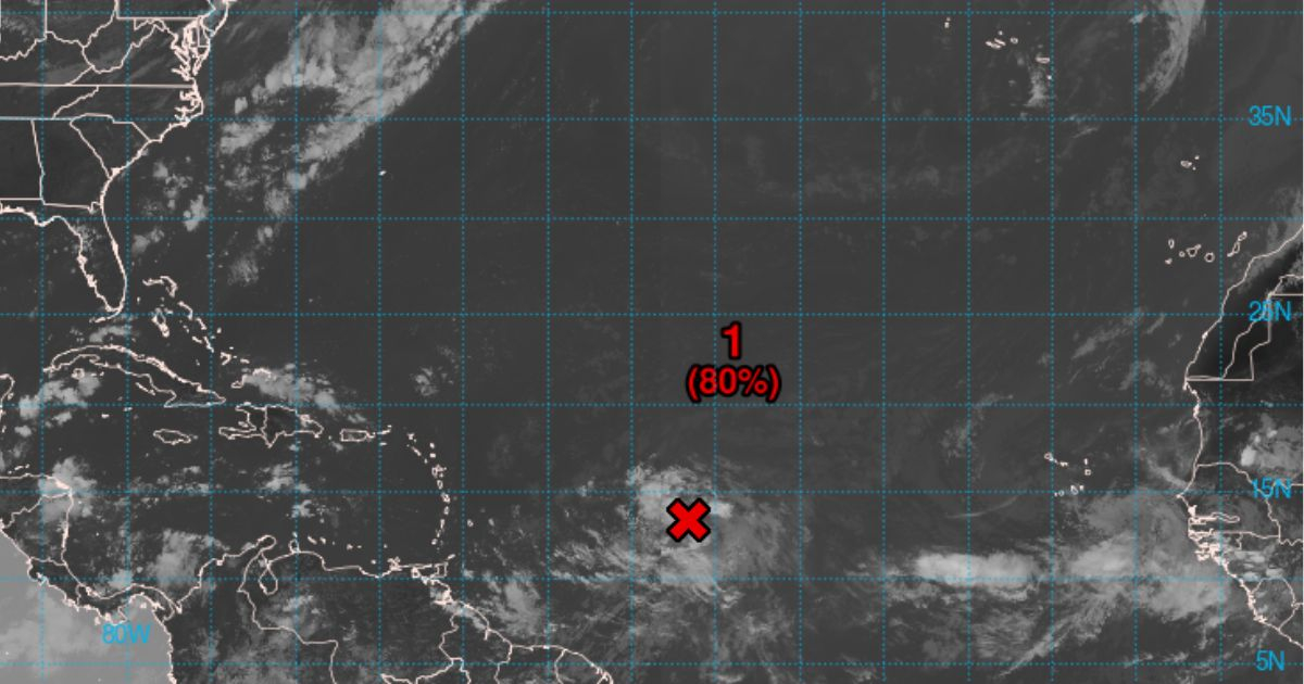
According to forecasts, there is an 80% chance that the system will develop into a tropical depression within the next 48 hours, and a 90% chance that it will happen within the next seven days.
This system, identified as AL98, is located less than 1,000 miles east of the Lesser Antilles and is associated with rain and thunderstorms that have begun to show signs of organization.
As it moves westward, it is expected to approach and possibly impact the Leeward Islands and parts of the Greater Antilles by midweek.
According to the NHC, residents of the Lesser and Greater Antilles should remain vigilant regarding the development of this system, as warnings are likely to be issued in the coming hours.
The development of this system could have a significant impact on the region, so the population is urged to be prepared and to stay informed about weather updates.
Cuban meteorologist Raydel Ruisanchez warned on Facebook this Sunday that forecasting models are consistent in predicting the formation of a tropical cyclone within the next 24 to 48 hours as it approaches the northern group of the Lesser Antilles.
"All residents within the red zone should pay close attention to potential changes and alerts that may be issued in the coming days," the specialist warned, while sharing a graph suggesting that the weather disturbance is unlikely to cause significant impacts in Cuba.
He indicated that after 72 hours, a trough could cause the system to shift northwest and north over the open waters of the Western Atlantic.
For several days now, close monitoring has been maintained of this weather disturbance due to its potential impacts on the Caribbean region.
The 2024 hurricane season continues to show signs of intense activity, with the Caribbean in the path of new weather threats.
The NHC stated that the peak is just around the corner—late August to late September—and that up to 13 hurricanes could occur in total from June 1 to November 30.
Filed under: