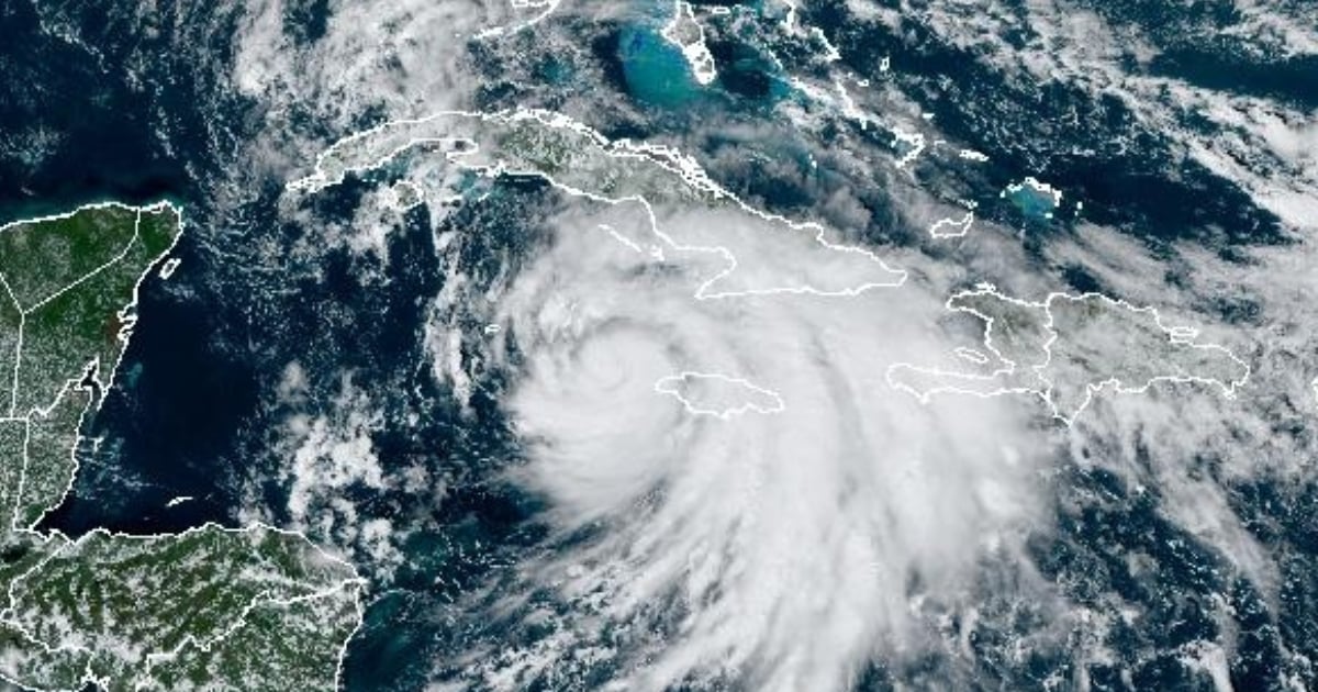
Tropical Storm Rafael, currently located in the central Caribbean Sea, has intensified its organization and continues to move northwest, while increasing rain and thunderstorm activity in the central and eastern regions of Cuba, according to the latest report from the island's Institute of Meteorology (INSMET).
On the social media platform Facebook, the entity reported that the atmospheric phenomenon has maximum sustained winds of 95 km/h and higher gusts, while maintaining a minimum central pressure of 994 hPa.
It was also updated that at 12:00 PM, its center was located approximately 50 km west-southwest of Punta Negril, Jamaica; 205 km south-southeast of Grand Cayman; and about 550 km southeast of Punta del Este, on the Isle of Youth. The storm is moving northwest at a translational speed of 20 km/h.
According to the forecast issued by INSMET, Rafael will maintain a similar course and speed over the next 12 to 24 hours, moving through the waters west of Jamaica and gradually increasing in organization and intensity.
There is a chance that the system will reach hurricane status as it approaches the Cayman Islands and could make landfall on the western coast of Cuba this Wednesday as a Category 2 hurricane.
It is expected that, throughout the afternoon and evening today, the rainfall will spread towards the western part of the island. The intensity of the winds and sea conditions in various areas of the country will depend on the trajectory and intensity that Rafael reaches in the coming hours.
In its latest update on the X platform, the National Hurricane Center (NHC) stated that the center of the cyclone is located to the west of the western tip of Jamaica and previously issued a tropical storm warning for the Florida Keys, United States.
In a report released on the morning of this Tuesday, meteorologist José Rubiera urged people to pay attention to the progression of Tropical Storm Rafael in the coming hours because, although the center of the weather phenomenon currently does not have a large cloud cover, it will acquire one when it makes landfall in Cuba.
In a report for his YouTube channel, the popular Cuban meteorologist indicated that the storm is gaining "structure rapidly," which could be further enhanced as it moves into the warm waters of the Caribbean Sea.
Regarding the possible trajectories, Rubiera clarified that they are currently very close together, but they are becoming more divergent as they approach Cuba due to an anticyclonic wedge that is steering the forecast to the northwest. However, there could still be changes in the trajectory in the coming hours.
Alerts and warnings
A hurricane warning has been issued for the Cayman Islands and several Cuban provinces: Pinar del Río, Artemisa, Havana, Mayabeque, Matanzas, and Isla de la Juventud. Additionally, a tropical storm warning is in effect for Jamaica and the Cuban provinces of Villa Clara, Cienfuegos, Sancti Spíritus, and Ciego de Ávila.
Additionally, a tropical storm warning has been issued for the Cuban provinces of Camagüey and Las Tunas, the Florida Keys from Key West to the 5 Mile Bridge, and the Dry Tortugas.
A total of 11 Cuban provinces and the Isle of Youth are under some form of warning.
The warnings indicate that hurricane winds could reach the affected areas within 36 hours, so it is advised that residents in those regions prepare for the arrival of the phenomenon.
Tropical storm conditions may occur in areas under warning, and these conditions are expected to be possible in areas under watch in the next 48 hours.
The dangers and impacts on land include strong winds, with hurricane conditions expected to reach the Cayman Islands this afternoon and the western part of Cuba, including the Isle of Youth, on Wednesday.
Recommendations for the population
Given the current situation and the projected trajectory, INSMET urges the population to pay attention to the communications issued by the Forecast Center of the Meteorological Institute, as well as to adopt the necessary preventive measures against potential increases in strong winds and storm surges in coastal areas as the storm approaches the southern seas of Cuba.
The next official tropical cyclone advisory is scheduled for 6:00 p.m. today, at which time updated details on Rafael's behavior and recommended safety measures will be provided.
What do you think?
COMMENTFiled under: