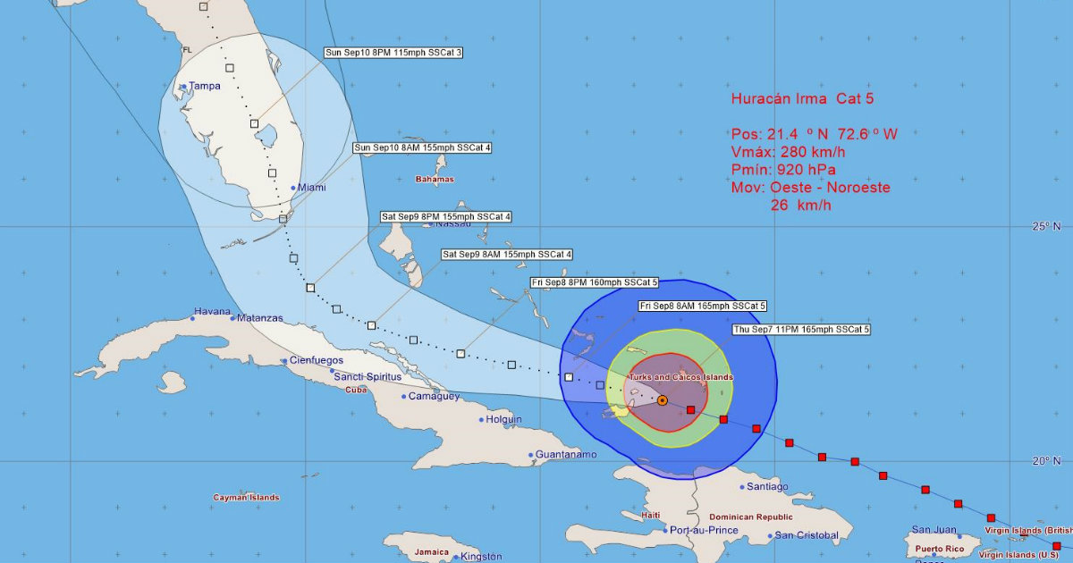
During the early hours of today Hurricane Irma has weakened slightly and has decreased its maximum sustained winds to 250 km/h. Although it is now at the upper limit of a Category 4 Hurricane, close to Category 5 on the Saffir-Simpson scale, it still remains a high intensity system.
Irma has continued its advance west-northwest, reaching the seas north of the eastern region of Cuba in the early morning hours, and its outer bands have increased rains in the provinces from Guantánamo to Camagüey, mainly towards areas of the coast north. Coastal flooding has also been reported on the northern coast of Guantánamo and Holguín.
Today it will be cloudy in the eastern region with showers and rain, strong and locally intense towards areas of the north coast and in mountainous localities, which from the end of the morning will extend to the central region where they may be strong from the morning. evening.
The winds in the eastern region will be from the northwest to the north between 50 and 65 km/h, up to 80 km/h with higher gusts in areas of the northern coast, and in the center of the country they will be from the north to the northeast between 35 and 50 km /h, which at night will reach between 50 and 65 km/h, up to 100 km/h in areas of the north coast, with higher gusts.
There will be strong storm surges between 5.0 and 8.0 meters with coastal flooding on the northern eastern coast during the morning, which will extend to the central region with coastal flooding that may be strong from the end of the afternoon. The section from Cabo Cruz to Punta Maisí will have storm surges with wave heights between 2.0 and 3.0 meters.
At six in the morning today the center of Irma was estimated at 21.8 degrees North latitude and 74.0 degrees West longitude, about 168 kilometers north of Punta de Maisí, Guantánamo, and 180 kilometers east northeast of Punta Lucrecia, Holguín. Its minimum pressure has risen to 925 hectoPascal and it maintains its course west-northwest at a rate of 26 kilometers per hour.
In the next 12 to 24 hours, Hurricane Irma will continue as an intense hurricane, moving on a similar course and decreasing its speed as it passes through the Old Channel of the Bahamas, but close to the northern coast of the central and eastern regions. from Cuba.
Due to the impact of this organization on Cuba, it is recommended to pay attention to the information issued by the Weather Forecast Center of the Institute of Meteorology and the guidelines of the National Civil Defense.
The next Tropical Cyclone Warning about the intense Hurricane Irma will be issued at nine in the morning today, Friday.
M. Llanes and N. Valderá
What do you think?
COMMENTFiled in: