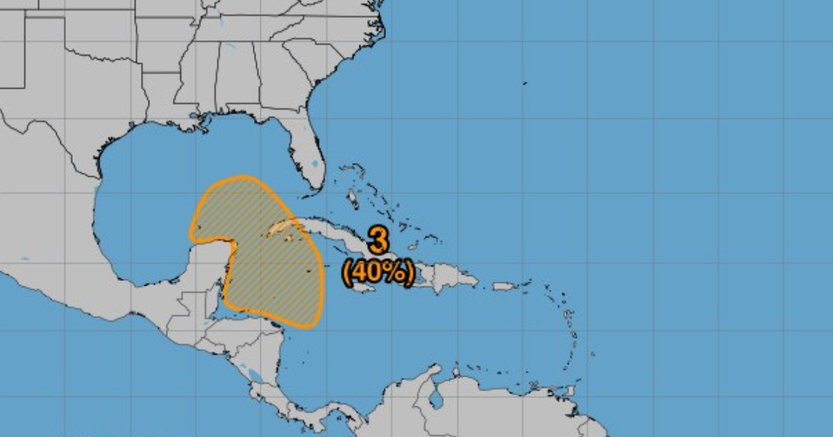
The National Oceanic and Atmospheric Administration (NOAA) warned this Thursday about the possible formation of a broad low-pressure area in the northwest Caribbean Sea and the southeast Gulf of Mexico.
According to a post on Facebook, NOAA has warned that this system could develop early next week in the western Caribbean Sea and move northwestward.
As it progresses, there is a possibility that this system may develop into a tropical depression as it slowly moves north or northwest, heading towards the southern Gulf of Mexico.
Although the likelihood of formation is virtually zero in the next 48 hours, the forecast shifts in the medium term, with a 40% chance that it will develop over the next seven days, NOAA warned.
Recently, Cuban meteorologist Raydel Ruisanchez noted on Facebook that a phenomenon could develop in this area and urged everyone to stay vigilant: "Nothing has formed yet, so we cannot determine where it will head. We will be keeping a close eye and will see if it materializes."
The current hurricane season is experiencing its peak activity. According to NOAA, this could be the most active season in the last 30 years, with forecasts indicating that up to 13 cyclones could form.
The 2024 hurricane season, which began on June 1 and will last until November 30, is expected to be very active due to favorable conditions for storm development, such as warmer sea temperatures and reduced vertical wind shear.
Filed under: