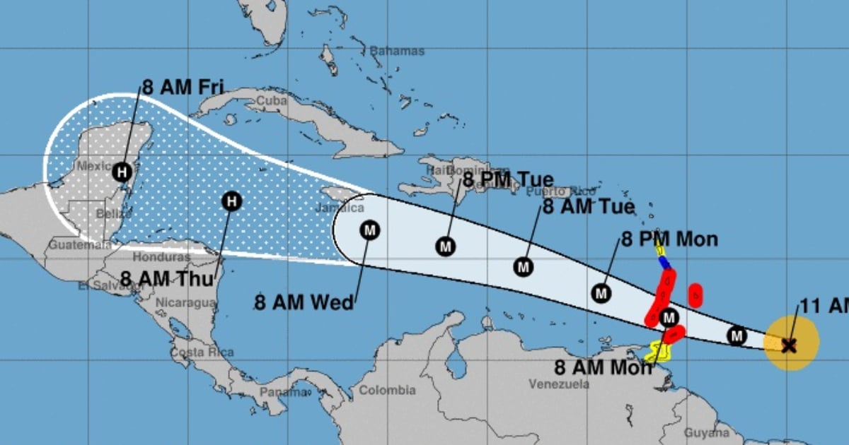
The National Hurricane Center (NHC) showed the trajectory cone of Cyclone Beryl, which remains away from the coasts of Cuba, while the Windward Islands, especially St. Vincent, the Grenadines, and Grenada, will face the impacts of the powerful Category 4 hurricane from early Monday morning.
"Hurricane-force winds, potentially catastrophic storm surges, and damaging waves are expected," the NHC pointed out in its report, published on the social network X.
"All preparations should be concluded quickly today," warned the meteorological agency.
The dangerous cyclone Beryl has made history by becoming the first recorded Category 4 Atlantic hurricane in the month of June, stated meteorologist Colin McCarthy on the social network X.
"We had never seen such a strong hurricane so early in the season," pointed out the meteorologist, highlighting that this has raised concerns within the scientific community regarding the current hurricane season, which was predicted to be particularly active.
The National Oceanic and Atmospheric Administration (NOAA) of the United States predicted a more active than usual hurricane season in the Atlantic, with the possibility of up to 13 hurricanes, of which up to seven could be of great intensity.
According to the annual forecast published by the entity every May, between June 1st and November 30th, there will be formed between 17 and 25 storms with winds exceeding 62 kilometers per hour.
What do you think?
COMMENTFiled under: