
Hurricane Beryl continues to move westward, increasing the strength of its winds, which is why it has been declared an "extremely dangerous hurricane" by the National Hurricane Center (NHC).
Beryl continues to rapidly intensify. The forecast indicates that it will bring potentially deadly winds and storm surges to the Leeward Islands as an extremely dangerous hurricane," the NHC reported from its account on X.
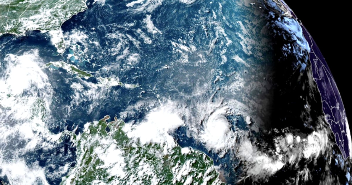
In its latest update, the NHC located the center of the hurricane near 10.7 north 53.1 west, moving westward at 18 knots (33.3 km/h).
The powerful hurricane has sustained maximum winds of 85 knots (157 km/h) with gusts up to 105 knots (194 km/h). Although winds and waves vary greatly in each quadrant, the meteorological center has recorded waves as high as 12 feet (3.65 meters).
It is expected that Beryl will be an extremely dangerous Category 4 hurricane when it reaches the Windward Islands early Monday, bringing destructive hurricane force winds and potentially deadly storm surges. Hurricane warnings are in effect for much of the Windward Islands, the NHC warned.
Likewise, he forecasted "heavy rains and localized flooding in the Windward Islands tonight and Monday," and recommended monitoring the progress of this system.
Users are reminded that there is great uncertainty in days 4 and 5 and they should not focus on specific track details or intensity forecast," warned the NHC, taking into account the evolution of the first hurricane of the season.
At the moment, the NHC issued a hurricane warning for the islands of Barbados, Saint Lucia, Saint Vincent and the Grenadines, and Grenada. For Martinique and Tobago, the warning is for a tropical storm.
"It is surprising to see a forecast for a major hurricane (Category 3+) in June in any part of the Atlantic, let alone so far east in the deep tropics. Beryl is rapidly organizing over the warmest waters ever recorded for late June. Hurricane watch for much of the Leeward Islands," tweeted expert Michael Lowry.
According to the map with the evolution forecast provided by Lowry, Hurricane Beryl would reach the eastern tip of Cuba on Wednesday morning, transformed into a Category 2 hurricane, with winds of 168 km/h.
On Thursday morning, it would be located to the south of the island, at the level of its central region, but already as a category 1 hurricane, with winds of 144 km/h.
The Weather Forecast Center of the Cuban Institute of Meteorology (INSMET) predicted some showers and thunderstorms for this Sunday. "The day will dawn mostly cloudy in the western region and partly cloudy in the rest of the country, with occasional showers in the extreme northeastern part. In the morning, it will be partly cloudy, and from the afternoon, it will become cloudy in most of the territory with some showers, rain, and thunderstorms," noted INSMET. About 3,000 kilometers away from Cuba, the effects of Beryl have not yet reached the largest of the Antilles. On Sunday, the winds will be from the east region, with speeds between 10 and 25 kilometers per hour and weak variables on the southern coast. "There will be little wave action, except on the northeastern coast where there will be waves, which will decrease to little wave action in the afternoon," specified INSMET, reminding that "in areas of showers and thunderstorms, wind strength and wave height may increase."
What do you think?
COMMENTFiled under: