Related videos:
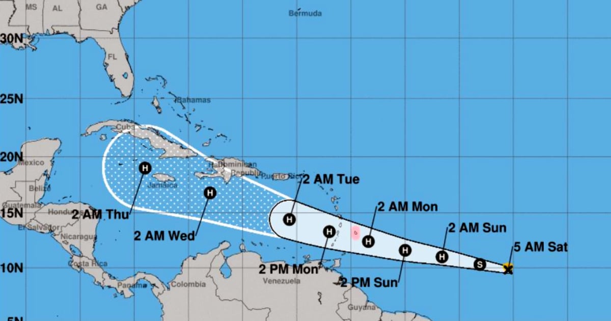
The second Tropical Depression of the current hurricane season, located this Friday in the Atlantic Ocean, has reached the category of Tropical Storm and threatens to become a hurricane on its path towards Cuba.
The Forecast Center of the Institute of Meteorology of Cuba (INSMET) issued a second advisory at 11 PM this Friday, warning of the formation of Tropical Storm Beryl, the second of the season following the formation of Alberto in mid-June.
"Tropical Depression Two showed signs of improved organization in its circulation, as well as an increase in areas of heavy rainfall near its center, leading to the determination that it has developed into Tropical Storm Beryl," stated INSMET.
The tropical storm has maximum sustained winds of 65 kilometers per hour, with higher gusts and a minimum central pressure of 1006 hectopascals.
At midnight on Friday, Beryl was moving in a direction close to west at a speed of 30 kilometers per hour, and “its center was located about 1,785 kilometers east-southeast of Barbados, the easternmost island in the Lesser Antilles.”
"In the next 12 to 24 hours, it is expected to continue moving in a west-northwest direction, gaining more organization and intensity, and it could become a hurricane by Sunday, before reaching the Lesser Antilles, the eastern boundary of the Caribbean Sea," warned the INSMET Forecast Center.
The next update regarding this system will be issued at six o’clock this Saturday evening. According to INSMET, "due to its evolution and future path, close monitoring of this tropical cyclone is ongoing."
Filed under: