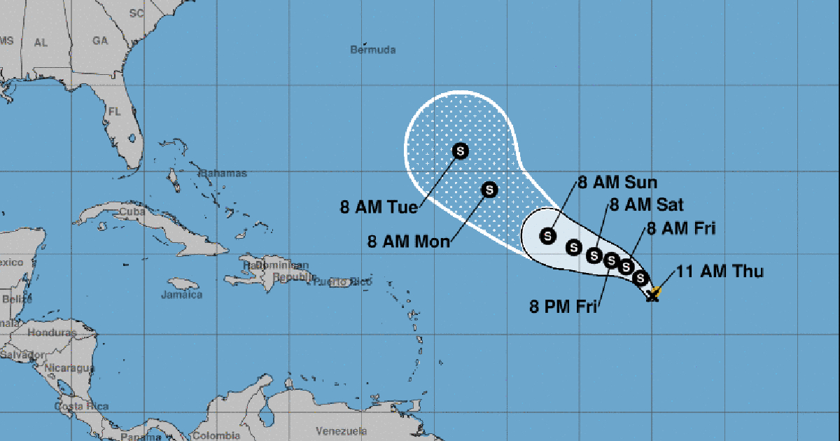
TheTropical Storm Rina It formed this Thursday in the Atlantic and is moving towards the north-northwest at a speed of 10 miles per hour (17 km/h), without posing any danger to Cuba.
Henotice number 1 The National Hurricane Center (NHC) of the United States on this tropical organism located its center at 11 a.m. near latitude 17.4 north and longitude 45.0 west, about 1,190 miles (1,915 km) north of the Leeward Islands.
According to the report, Rina is moving north-northwest, and is expected to turn further west later today or on Friday.
Its maximum sustained winds are near 40 mph (65 km/h), and it has stronger gusts. The NHC forecasts it to gradually strengthen over the next few days. Tropical storm-force winds extend up to 60 miles (95 kilometers) from the center.
Its estimated minimum central pressure is 1,005 mb (29.68 inches).
While thetormenta tropical Philippe, which formed last weekend, will move slowly and remain east of the Northern Leeward Islands for the next few days, according to theNHC prognosis.
This tropical organism does not represent a danger to Cuba either.
At the end of last August,Hurricane Idalia hit the western region of Cuba, with strong winds and intense rains that caused river flooding and coastal flooding in the provinces of Pinar del Río and Artemisa. In Havana it was reportedseveral landslides.
Idaliamade landfall in Florida as a category 3 hurricane, leaving floods and destruction in their wake. It also caused significant damage in the Carolinas.
For the current Atlantic hurricane season, which will end on November 30, the US National Oceanic and Atmospheric Administration (NOAA) had predictedbetween 12 and 17 storms with names, with winds of 39 mph or higher, of which between five and nine could become hurricanes, with winds of 74 mph or higher.
What do you think?
COMMENTFiled in:


