Related videos:
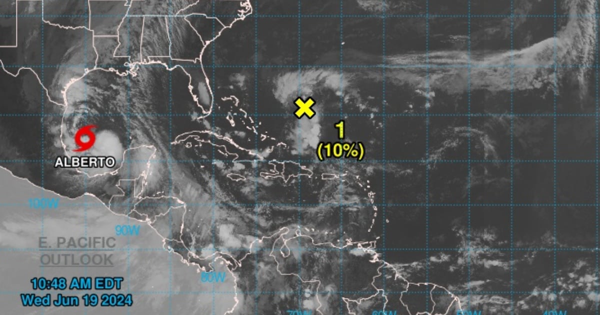
Tropical Storm Alberto, the first of the current hurricane season, formed in the western Gulf of Mexico, the National Hurricane Center (NHC) of the United States reported on Wednesday.
The weather center's advisory #8, issued at 10 a.m., warned of tropical storm conditions expected in that area of the Gulf and northeastern Mexico until Thursday, including heavy rain, coastal flooding, and gusty winds extending far from the center, as Alberto is a system of significant magnitude.
At 10:00 a.m. CDT (1500 UTC), the center of tropical storm Alberto was located near latitude 22.2 north and longitude 95.0 west, approximately 185 miles (300 km) east of Tampico, Mexico, and about 295 miles (480 km) south-southeast of Brownsville, Texas; with maximum sustained winds of 40 mph (65 km/h), the report indicated.
"An increase in the forward speed is expected until Thursday. According to the projected path, the center of Alberto will reach the northeastern coast of Mexico by Thursday morning," stated the NHC.
Meteorologists indicated that moderate coastal flooding is occurring due to this tropical storm along much of the Texas coast, and it will continue until Thursday.
"The maximum sustained winds are nearing 40 mph (65 km/h), with stronger gusts," explained the NHC, which forecasts a "slight strengthening" of the storm during Wednesday or at night, "before the center of Alberto makes landfall," while predicting a "rapid weakening once the center moves inland."
"It is likely that Alberto will dissipate over Mexico on Thursday or Thursday night," the advisory stated.
"Alberto is a large tropical storm, with tropical storm-force winds extending up to 415 miles (665 km) north of the center. The minimum central pressure, according to probe data, is 995 mb (29.39 inches)," it concluded.
On the morning of this Wednesday, the National Hurricane Center announced that the first potential cyclone of the 2024 season was emerging in the Gulf of Mexico as a disturbance, bringing heavy rains, coastal flooding, and gusty winds to the coasts of Texas and northeastern Mexico.
Last week, the National Oceanic and Atmospheric Administration (NOAA) of the United States forecasted a more active hurricane season in the Atlantic than usual, with the possibility of up to 13 hurricanes, of which as many as seven could be of high intensity.
According to the annual forecast published by the organization every May, between June 1 and November 30, there will be between 17 and 25 storms formed, with winds exceeding 62 kilometers per hour.
Filed under: