
Showers, rain, and thunderstorms are occurring in the west and center of the country this Thursday and will continue on Friday, due to a cold front over the Florida Strait, very close to the western tip of the island, reported the Institute of Meteorology (Insmet) of Cuba.
"The presence of a cold front or extended frontal trough over the Strait of Florida, very close to the western region of Cuba, combined with a broad low-pressure center in the western Caribbean Sea, a tropical wave, and other factors, encourages atmospheric instability, creating very favorable conditions for the occurrence of showers, rain, and thunderstorms," the Insmet indicated in a note published on its social media.
The communication specified that these weather conditions will continue tomorrow in the western and central regions, especially on the northern coast, "with the additional effect that the strength of the wind should increase."
In the weather forecast for tomorrow, Friday, the Insmet Forecast Center provided extensive information about the weather conditions that will prevail in the country.
In the western and central parts of the country, it will be cloudy, with downpours, rain, and isolated thunderstorms along much of the northern coast throughout the day, while there will be some showers and rain in the interior and southern regions in the afternoon, the report indicated. In the eastern part of the country, it will be partially cloudy, and in some areas, it will become cloudy with isolated precipitation. Minimum temperatures will range between 21 and 24 degrees Celsius; they will be lower in inland locations and higher in coastal areas. Meanwhile, maximum temperatures will range between 28 and 31 degrees Celsius in the western half, and up to 34 degrees Celsius in the rest of the country, the forecast stated. Winds will blow from the northeast at speeds between 10 and 25 kilometers per hour, reaching up to 35 km/h in areas of the northern coast of the west and center, where higher gusts will be recorded.
On the northern coast of the western region, swells will persist, causing slight water accumulations in low-lying areas, including the Malecón of Havana. Additionally, there will be wave activity on the central and eastern northern coast, while the southern coast will experience little wave activity, except in the south of Guanahacabibes and the Isle of Youth, where swells will occur. At the end of its forecast, the Forecast Center warned that in areas of showers and rain, wind speed and wave height may increase.
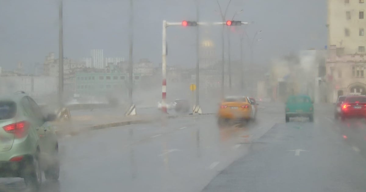
Since early Thursday morning, Havana has been hit by heavy rains that have caused flooding in multiple areas of the Cuban capital, especially in low-lying areas and those with poor drainage.
The current atmospheric conditions, as a result of the combination of the stationary cold front and the trough in the Gulf of Mexico, maintain a high probability of heavy rains in much of the country, with the western region being the most affected. The risk of flooding remains high.
As of 9:30 a.m., areas such as San José de las Lajas, Jaruco, and Catalina de Güines had recorded more than two inches of rain (50 mm) in just three hours.
In Havana, the Casablanca weather station reported a total of 42.9 mm of precipitation from dawn until 8:00 a.m.
What do you think?
COMMENTFiled under: