
In light of the advance of Hurricane Oscar and its imminent contact with the territory of Eastern Cuba, the country's authorities declared the alert phase for the province of Camagüey and the information phase for Ciego de Ávila.
“Alert Phase established for the province of Camagüey and informative phase for Ciego de Ávila,” reported the official journalist Lázaro Manuel Alonso on his social media.
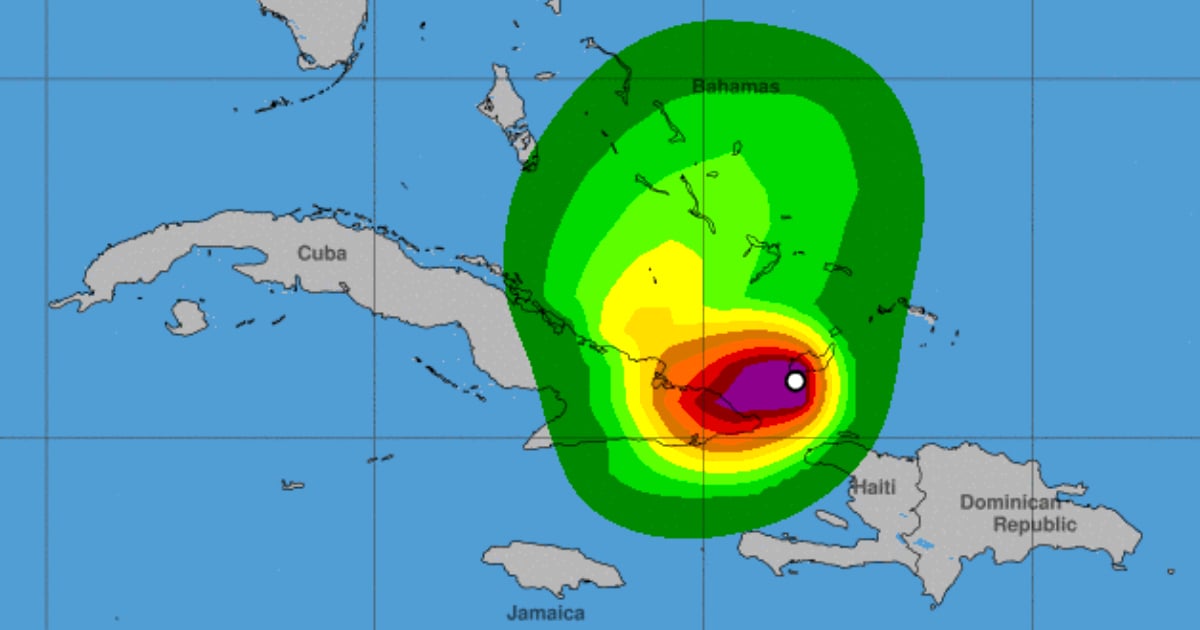
Hurricane Oscar continues its movement between west and west-southwest, which –according to the Forecast Center of the Institute of Meteorology (INSMET)– indicates that it could be making landfall this afternoon or evening along the northern coast near the provinces of Guantánamo and Holguín.
Taking the above into account, it was decided to establish the Cyclonic Alert Phase for the provinces of Guantánamo, Santiago de Cuba, Holguín, Granma, and Las Tunas starting at 07:00 hours today.
A little later, starting at 11:00 am, the Alert phase was also implemented in the province of Camagüey. The Civil Defense also decided to move to the Informative Phase in the province of Ciego de Ávila.
"The weather conditions will begin to deteriorate in the eastern region starting this morning, gradually increasing areas of showers, rain, and thunderstorms, which may be strong and locally intense in some localities and in the mountainous areas," highlighted the official portal Cubadebate.
The eastern northern coast will be affected by strong swells from noon today, mainly to the north of the provinces of Guantánamo, Holguín, and Las Tunas. In low-lying areas of this coastline in these provinces, including the Malecón of Baracoa, moderate coastal flooding will occur.
In addition, hurricane-force winds, storm surges, and heavy rains are likely to cause flash floods and landslides in eastern Cuba.
According to the latest report from the National Hurricane Center (NHC), it is estimated that winds will begin to affect the region this Sunday afternoon, around 2 p.m., intensifying until the night and early hours of Monday.
It is expected that municipalities such as San Antonio del Sur, Caimanera, Contramaestre, Palma Soriano, Mayarí, Antilla, and the coastal areas around Guardalavaca will experience conditions of greater intensity.
Reports on social media indicate that the first rains are already being felt in some areas of eastern Cuba, especially in Guantánamo and Santiago de Cuba.
According to the NHC, tropical storm winds are expected to reach Guantánamo starting Sunday at 2 p.m., extending to Santiago de Cuba and Holguín by 8 p.m. During the early hours of Monday, conditions could worsen in the eastern provinces, with wind gusts exceeding 113 km/h.
What do you think?
COMMENTFiled under: