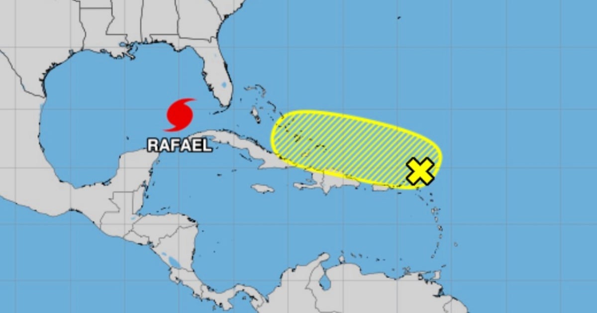
The National Hurricane Center (NHC) reported that a low-pressure trough moving westward near the Greater Antilles could experience "gradual development" over the next few days and generate rain in the area.
The weather phenomenon is currently located over the northern part of the Windward Islands, "generating disorganized rain and thunderstorms," according to a bulletin issued by the NHC early Thursday morning.
"Although a cyclone may not form, intense localized rain could occur in the northern Leeward Islands, the Virgin Islands, Puerto Rico, Hispaniola, and the southeast Bahamas until Saturday," concluded the U.S. National Hurricane Center, which did not mention Cuba among the potential areas affected by the weather phenomenon.
The chances of the weather phenomenon developing in the next 48 hours to a week are currently low, at only 20 percent.
A trough is an elongated region of relatively low atmospheric pressure that extends from a low-pressure area to higher pressure areas. They are associated with atmospheric instability, which often leads to the rising of air, cloud formation, and, in many cases, precipitation and storms.
In general terms, troughs are important in meteorology as they indicate areas where changes in the weather are more likely to occur, including rainfall and temperature variations. They can happen in any region, both in tropical climates and in mid-latitude areas.
In addition to the trough moving westward toward the Caribbean Sea, the hurricane Rafael continues to move northwest in the southeast Gulf of Mexico. On Wednesday, it struck western Cuba with great force, causing significant material damage.
The current hurricane season will end on November 30.
What do you think?
COMMENTFiled under: