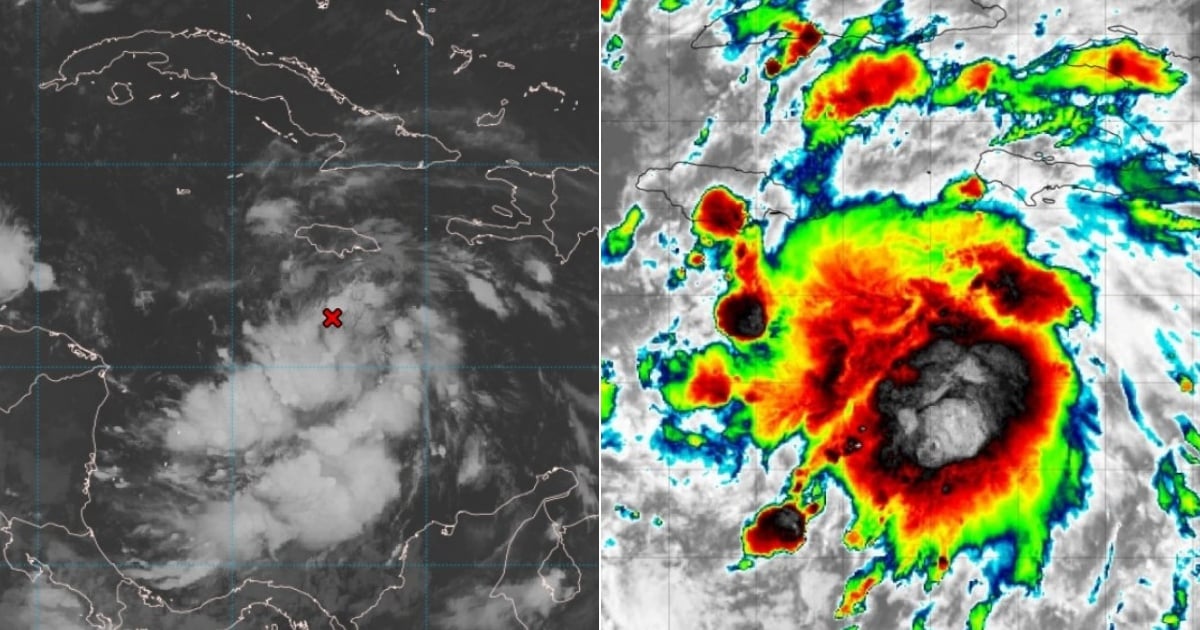
The tropical wave moving through the central Caribbean Sea, with a high likelihood of imminently becoming a tropical depression, is being closely monitored by Cuba's Meteorology Institute (INSMET).
"Within this active tropical wave, a broad area of low pressure has formed this morning. This system is expected to move slowly over the next few days towards the west across the western Caribbean Sea, where it will encounter favorable atmospheric and marine conditions for better organization and development, with a high likelihood of becoming a tropical cyclone within two to three days," stated Cuban meteorologist Frank Fernández Castañeda.
The specialist added that numerical weather prediction models show various solutions regarding the future paths of this potential tropical cyclone.
What is concerning is that some of those models show the weather phenomenon—should it develop into a tropical storm, it will be named Sara—crossing over western Cuba.
However, Fernández Castañeda warns that “since a cyclonic system has not yet formed, and considering how variable the atmosphere is,” it is not possible to “predict with certainty the trajectories or intensities, so it cannot be stated, without a formed cyclone, that our territory will be affected.”
"Although the system still needs to develop for more accurate forecasts, runs from some models at this hour suggest concerning trajectories. This is why the INSMET Forecast Center is maintaining vigilance over this low-pressure area, considering its location and the time of year," wrote pro-government journalist Lázaro Manuel Alonso on Facebook.
What does the National Hurricane Center of the United States say?
In its most recent bulletin, the National Hurricane Center (NHC) forecasted that a new tropical depression will form within 48 hours.
The meteorological entity noted that a large area of low pressure over the central Caribbean Sea continues to produce a significant area of rain and thunderstorms, and that the environmental conditions are favorable for development.
As indicated by the NHC in previous updates, the system is currently moving slowly westward toward the western Caribbean Sea, but it is likely to shift its trajectory to the northwest next week, which will understandably heighten concerns for Cuban territory.
"It is likely that there will be greater development as the disturbance meanders over the western Caribbean Sea during the weekend. The system is expected to slowly turn northwest early next week," the NHC added.
The National Hurricane Center alerted that interests in the western and northwestern Caribbean Sea should monitor the progress of this system.
Regardless of the development, heavy rain is imminent over Jamaica.
A U.S. Air Force hurricane-hunting aircraft is expected to investigate this system today.
The news of the meteorological phenomenon shifting northwest is troubling for Cuba, which faced the impact of Hurricane Oscar in Guantánamo less than a month ago, followed by the assault of Hurricane Rafael in Artemisa and the rest of the western provinces.
Although the official end of the 2024 hurricane season in the Atlantic is on November 30, meteorological threats continue unabated.
Filed under: