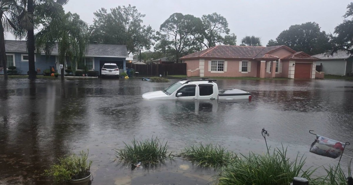
The authorities in Florida recommended on Wednesday to avoid unnecessary road travel due to the threat of new flash floods, especially on the state's east coast, where heavy rain is expected in the coming days.
The Florida Division of Emergency Management (FDEM) issued the warning through its official account on X, indicating that heavy rainfall will increase the risk of flash flooding in various areas of the Atlantic coast.
The agency urged residents to limit non-essential travel, to respect the barriers set up on the roads, and not to attempt crossing flooded streets, even when the water appears shallow.
The warning includes a particularly dangerous fact for drivers: just one foot of water, equivalent to about 30 centimeters, can sweep away a vehicle.
The authorities also recommended following the alerts and guidance from local officials, as conditions can deteriorate rapidly when heavy rainfall impacts roads, underpasses, and low-lying areas.
The east coast of Florida faces several days of danger
The state notice aligns with the forecasts from the National Weather Service (NWS), which this Wednesday identified a moderate risk of excessive rainfall for the regions of Space Coast and Treasure Coast, in the central-eastern and southeastern parts of Florida.
According to the NWS Weather Prediction Center, the atmospheric conditions are conducive to the formation of storms that can linger over the same area or repeatedly discharge on it, which increases the risk of significant water accumulation.
The danger is not confined to a single day. Forecasts suggest the possibility of new bands of rain along the Atlantic coast over the coming days, with a gradual shift of the high-risk areas towards the north.
The warning comes as flooding is already affecting several areas of South Florida, with streets submerged and vehicles stranded. Miami-Dade, Broward, and Palm Beach are under flood watch until Thursday night, due to the possibility of ongoing heavy rainfall.
During the early hours of Wednesday, the NWS also warned of flash flooding in areas of southern Broward, where radar estimates indicated accumulations of between eight and 11 inches of rain.
The threat had been announced since the beginning of the week. The initial forecasts predicted accumulations of up to 12 inches in areas of the east coast, and the NWS had issued a flood watch for nine counties in central-eastern Florida, including Brevard, Volusia, Orange, Seminole, and St. Lucie.
Part of the danger is due to the fact that some communities still have soils saturated from previous rains, which reduces the ground's ability to absorb new precipitation and increases the likelihood of flooding.
What to do if you encounter a flooded road
The main recommendation from the authorities is to not drive through accumulated water on the roads. The depth may be hard to gauge, and the current could be stronger than it seems.
Drivers should also not go around barricades or use routes closed by emergency services. If they encounter a flooded street, they should look for a safe alternative route.
The Division of Emergency Management reminded that local alerts are essential for understanding changes in weather conditions and potential restrictions on movement.
For those who have already suffered damages during the recent floods, the state provides information on assistance and recovery at FloridaDisaster.org/FallFlooding.
Residents can also consult the official safety recommendations for flooding, which include protective measures before, during, and after these events.
Related videos:
Filed under: