
The National Hurricane Center warned that tropical storm Helene "will become quite large and powerful before making landfall," predicting that upon its arrival in Florida, it will be a major intensity hurricane.
"The conditions seem quite favorable for strengthening over the eastern Gulf of Mexico on Wednesday and Thursday," they noted in a statement that follows this meteorological phenomenon that has put areas of countries like Cuba and Mexico on alert.
Lisa Bucci, a hurricane specialist, made a call urging people not to be misled by the size of the currently existing cyclonic system. "We expect it to rapidly intensify," she stated to Telemundo.
He also added that people in the regions under surveillance and warning should be prepared to be without electricity and have enough food and water for at least three days.
In the southeastern United States, Helene is expected to produce total rainfall accumulations of 4 to 8 inches, with isolated totals around 12 inches. This rain will likely result in areas of significant flash flooding and urban flooding, with chances of minor to moderate flooding on rivers and possible isolated flooding of larger rivers, reflected a report from wapatv.
This Monday, Governor Ron DeSantis issued Executive Order 24-208, declaring a state of emergency in 41 counties in Florida that may be affected by the storm and ordering agencies to prepare as needed.
The regulation excludes the southeast part of the state, leaving out the counties of Palm Beach, Miami-Dade, and Broward.
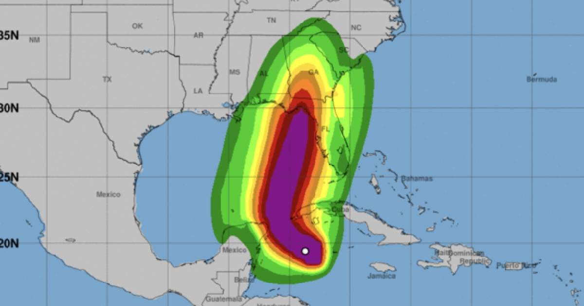
A map from the National Hurricane Center shows that Helene will move north through the Panhandle region on Thursday night. Tallahassee, the Florida capital, is at the center of the projected path.
The forecast also indicates that many areas will experience dangerous storm surges, especially between Panama City and Tampa.
The coast extending from the Ochlockonee River to Chassahowitzka could be subjected to between 10 and 15 feet of water. Nearby areas could experience between 5 and 10 feet of water, and the Tampa Bay area is forecasted to see between 5 and 8 feet of storm surge, adds CBS News.
What do you think?
COMMENTFiled under: