
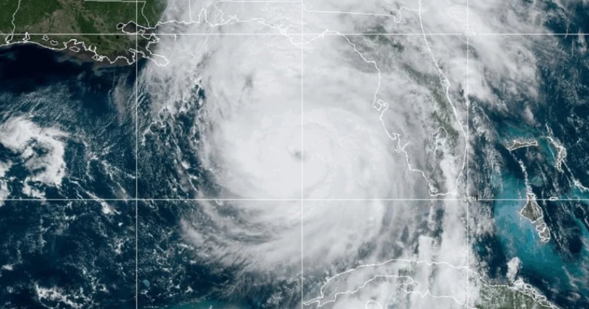
The National Hurricane Center (NHC) officially reported that the atmospheric phenomenon Helene is now a Category 4 hurricane on the Saffir-Simpson scale, with maximum sustained winds of 130 miles per hour (215 km/h).
On the social network X, a recent post from the entity warned that the storm has strengthened on its path over the warm waters of the Gulf of Mexico.
"A NOAA hurricane hunter aircraft currently investigating Helene recently discovered that the maximum sustained winds have increased to 130 mph (215 km/h). The minimum central pressure has also dropped to 947 mb (27.96 inches), according to the data from the probe," stated the NHC.
It had only been a few hours since it had become a category 3 hurricane.
Helene is expected to make landfall tonight with torrential rains, powerful winds, and dangerous storm surges. Florida's northern coast, the area known as the "Big Bend," is preparing for the impact.
According to the National Oceanic and Atmospheric Administration (NOAA), catastrophic storm surges are likely along the "Big Bend" coast, where flooding could reach up to 20 feet above ground level.
What do you think?
COMMENTFiled under: