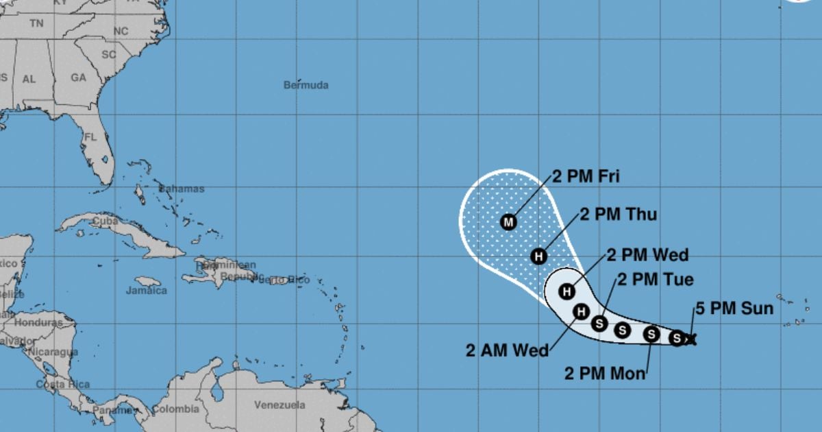
The National Hurricane Center (NHC) reported this Sunday on the formation of Tropical Depression 12 in the eastern tropical Atlantic.
"It could become a formidable hurricane later this week," the NHC warned in a post on the social media platform X.
Although the twelfth tropical depression of the season that just formed southwest of Cape Verde will remain far from the Caribbean, meteorologist Suheily López Belén warned on Facebook that it could influence maritime conditions.
"Conditions at sea could be affected next weekend with the arrival of swells if it develops into a strong hurricane further out in the Atlantic," López noted.
"It is expected to soon become Tropical Storm Kirk, on Wednesday a hurricane, and by the end of the week a strong hurricane," emphasized the expert.
American meteorologists warned this Saturday about the arrival of a tropical moisture area from the Caribbean Sea, which could develop into a depression south of Cuba, just after the impact of Hurricane Helene.
Although the exact path of this system has not yet been determined, the situation is being closely monitored, NBC6 reported.
It is a tropical wave currently located in the central Caribbean, south of Cuba, and it could develop into a low-pressure area as it moves westward.
The National Hurricane Center has indicated that there is a 40% chance of this system developing into a tropical depression by the middle of next week as it moves toward the Gulf of Mexico.
The NHC recently announced the formation of tropical storm Joyce and hurricane Isaac in the Atlantic Ocean.
Joyce is the tenth named storm of the current season and is located over the open waters of the tropical Atlantic Ocean, approximately 1,325 miles (2,130 km) east of the northern Windward Islands, north of Venezuela.
On the other hand, Hurricane Isaac was located this Saturday about 1,080 miles (1,740 km) west of the Azores and was moving east-northeast at nearly 18 mph (30 km/h).
Filed under: