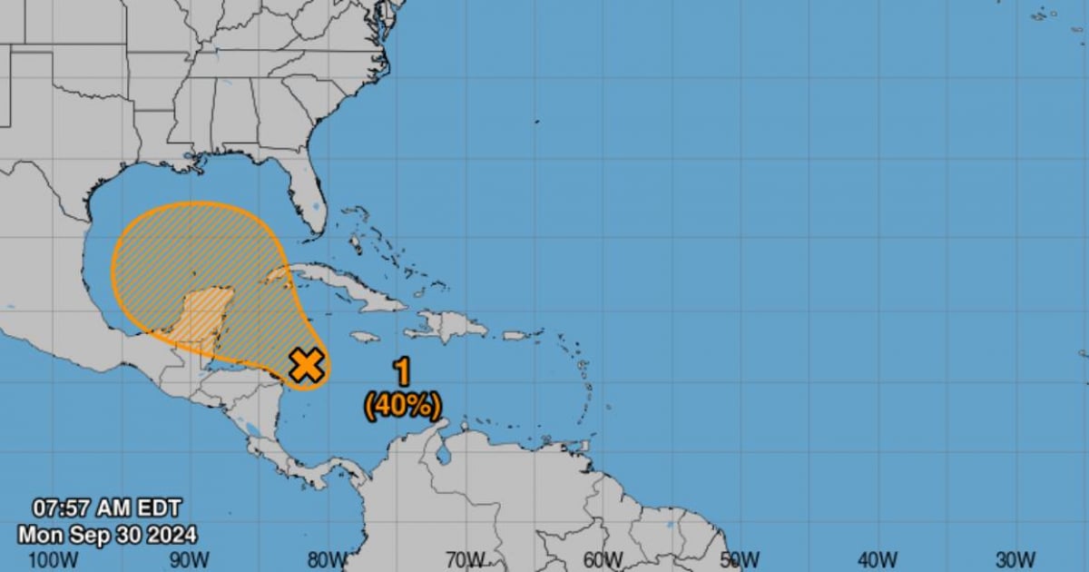
The National Hurricane Center (NHC) reported this morning that it is monitoring a large area of low pressure in the western Caribbean, in the same location where Hurricane Helene formed, which affected Cuba, Mexico, and more intensely Florida, last week.
Currently, this area of low pressure is disorganized, but environmental conditions could become more favorable for its development in the coming days, increasing the chances of it becoming a tropical depression by the end of this week.
The NHC explained that, although the rains and thunderstorms associated with this system are not yet showing signs of organization, the low-pressure area could gradually strengthen as it moves northwest, reaching the southern Gulf of Mexico or the northwest Caribbean Sea.
The chances of formation are low in the next 48 hours, although they increase to 40% in the next seven days.
Active systems in the Atlantic
The NHC is issuing notices about tropical storm Isaac, located several hundred miles north of the Azores, and about tropical depression Joyce.
Tropical Storm Kirk also formed, and there is another area under surveillance in the eastern Atlantic.
Forecast and recommendations
Tropical Storm Kirk is located near latitude 13.5 North, longitude 34.8 West. It is moving west at about 12 mph (19 km/h), and it is expected to maintain this motion until Tuesday. A gradual turn toward the northwest is forecasted for Wednesday.
Meteorologists recommend that people in the northwest Caribbean Sea and along the U.S. Gulf Coast closely monitor the evolution of these systems.
Its development could take several days, but conditions may become favorable for the formation of a tropical cyclone by the end of the weekend.
What do you think?
COMMENTFiled under: