
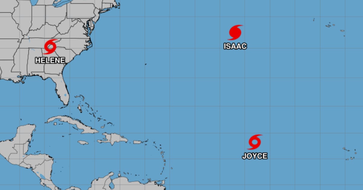
While Hurricane Helene continues to wreak havoc in the United States, the National Hurricane Center (NHC) announced the formation of Tropical Storm Joyce and Hurricane Isaac in the Atlantic Ocean.
Joyce is the tenth named storm of the current season and is located over the open waters of the tropical Atlantic Ocean, about 1,325 miles (2,130 km) east of the Northern Windward Islands, north of Venezuela.
It is moving northwest at about 13 mph (20 km/h) with maximum sustained winds of around 40 mph (65 km/h) with stronger gusts.
According to the NHC, it is expected to move westward across the Atlantic and strengthen slightly until Saturday. It should then turn north and gradually weaken early next week.
On the other hand, Hurricane Isaac is located about 1,080 miles (1,740 km) west of the Azores and is moving east-northeast at nearly 18 mph (30 km/h). It is expected to gain speed in the coming days.
It has maximum sustained winds of about 75 mph (120 km/h), with stronger gusts. On Saturday, it is expected to strengthen before gradually weakening by the end of Sunday.
In addition, the Cuban meteorologist Raydel Ruisánchez reported on Facebook that there are two more disturbances with the potential for development in the Caribbean Sea.
"The peak of the season seems to occur now as we are already finishing September," she warned.
Hurricane Helene weakened to a tropical storm on Friday, hours after making landfall on the northwest coast of Florida as a category 4 hurricane.
During this morning, it moved to the north-northeast and then tilted its course to the north, increasing its translation speed to 48 km per hour. Although the prediction was that the storm surge on the west coast of Florida would decrease, damaging wind gusts will continue to penetrate inland in parts of Georgia and the Carolinas.
Helene made landfall on Thursday night in the Big Bend region of Florida, where it impacted with maximum sustained winds of 225 km per hour, storm surges described as "catastrophic," and heavy rains that caused seawater inundation and flooding.
At least one person died when a traffic sign fell on their vehicle while traveling on I-4 highway in the city of Tampa, as confirmed by the Florida Highway Patrol (FHP).
What do you think?
COMMENTFiled under: