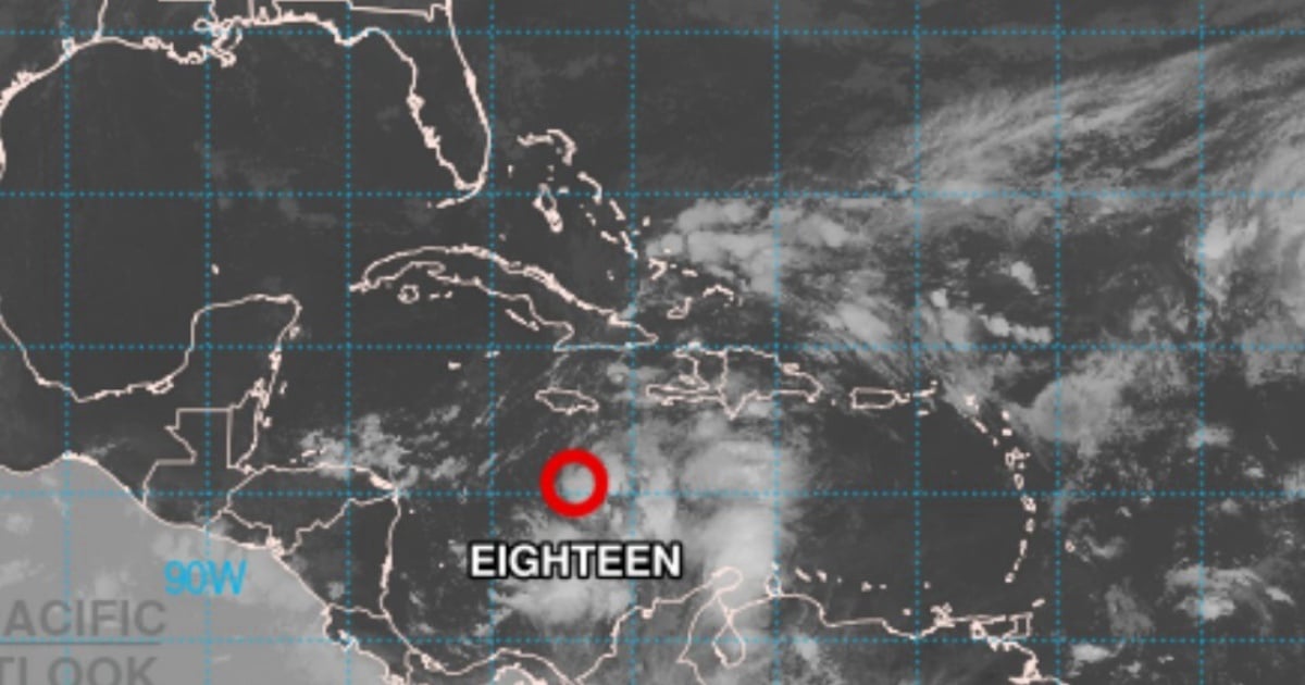
The Forecast Center of the Meteorology Institute (INSMET) issued its Tropical Cyclone Warning No. 1 at 10 a.m. (local time), alerting about the formation of Tropical Depression Eighteen in the Caribbean Sea and the need for the Cuban population to stay informed about the phenomenon at all times.
"Today, rain, showers, and thunderstorms will continue in the eastern provinces, which may be strong and intense in some localities. The precipitation will extend from this afternoon into the night towards the central region and later to the western part of Cuba," stated INSMET.
The entity added that "the effects of the wind and sea in the different regions of the country will depend on the path and intensity that this tropical cyclone reaches."
The Meteorological Institute indicated that at 10 a.m., the central region of the Tropical Depression was located about 310 kilometers south of Kingston, Jamaica, and 515 kilometers south-southeast of Cabo Cruz, Granma.
The phenomenon is currently moving in a direction close to north at a translation speed of 15 km/h.
The system has sustained maximum winds of 55 km/h, with higher gusts, and a minimum central pressure of 1003 hPa. It is expected that in the next 12 to 24 hours, the system will continue moving at a similar forward speed, shifting its course to the northwest near Jamaica.
"During its movement, it will gain more organization and intensity, and in the coming hours, it is expected to develop into a tropical storm, which could then reach hurricane status near the Cayman Islands," warns INSMET. The notice also indicates that during the early morning and morning hours today, the area of low pressure in the central Caribbean Sea had become better organized, and a reconnaissance plane found that it had developed into Tropical Depression Eighteen south of Jamaica.
"Considering the current position and future trajectory of this organization, it is essential to pay close attention to its evolution, the potential impacts on the national territory, and the information released by the Forecast Center of the Institute of Meteorology," the note concluded. The next advisory on this tropical cyclone system will be issued at six o'clock this evening, Monday.
The National Hurricane Center (NHC) issued a bulletin stating that a Hurricane Watch has been issued for the provinces of Pinar del Río, Artemisa, Havana, Mayabeque, Matanzas, and the Isle of Youth.
Additionally, a Tropical Storm Watch has been issued for the provinces of Villa Clara, Cienfuegos, Sancti Spíritus, Ciego de Ávila, Camagüey, and Las Tunas.
These precautionary measures aim to anticipate potential hurricane and tropical storm conditions in the next 48 hours.
According to the NHC, significant impacts are expected in Cuba.
Hurricane conditions are expected in the western part of the country and on the Isle of Youth on Wednesday, while tropical storm conditions may be observed in the central region of the island.
The rains associated with the system could be intense, with accumulations ranging from 75 to 150 mm and localized maxima of up to 225 mm, which could trigger flooding and landslides in vulnerable areas.
Additionally, there is a warning about the possibility of cyclonic surges that could raise water levels by 0.6 to 1.2 meters along the southern coast of Pinar del Río and the Isle of Youth.
An increase in wave activity is also expected to impact much of the western Caribbean in the coming days.
At six o'clock in the evening this Sunday, the Civil Defense of Cuba declared the informational phase for the provinces from Pinar del Río to Camagüey, including the special municipality of Isla de la Juventud.
According to the state agency, the provinces of Camagüey, Ciego de Ávila, Sancti Spíritus, Cienfuegos, Villa Clara, Matanzas, Mayabeque, La Habana, Artemisa, Pinar del Río, and the Special Municipality of Isla de la Juventud are moving to this phase due to the organization observed in the area of low pressure in the southern part of the western Caribbean Sea.
What do you think?
COMMENTFiled under: