Related videos:
The sixth cold front of the current winter season is causing rain and storms in the western part of Cuba as it moves eastward.
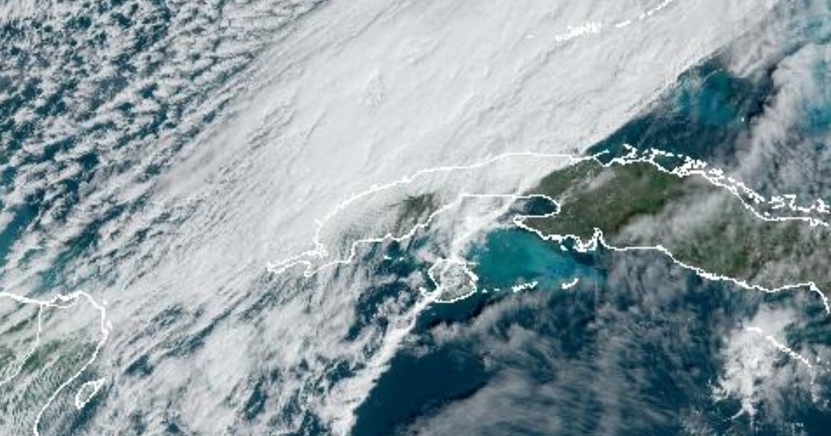
The Institute of Meteorology (INSMET) shared a image of the cold front located at 2:00 PM over Matanzas on Facebook.
"The thermal contrast in Cuban territory is evident. In the west, temperatures at this hour are between 19 and 22°C, while in the rest of the country, temperatures exceed 30°C," the post details.
According to the agency's latest report, during the early morning hours, the system entered the western part of Cuba, which prompted some showers and rainfall in this region, particularly in the province of Pinar del Río.
The highest rainfall accumulation was 10.4 millimeters, recorded by the Santa Lucía weather station.
This Wednesday will be a wintry day across the entire region, with rain and showers, as well as somewhat strong winds from the north and rough seas along the entire northern coast.
At 7:15 am, the weather station in Bahía Honda, Artemisa, reported a maximum gust from the north of 59 km/h. At 8:50 am, the Casablanca station in Havana reported a maximum gust of 60 km/h.
Minimum temperatures ranged between 17 and 20 °C. The lowest value was recorded in Indio Hatuey, in Matanzas, at 15.4 °C.
At 11:00 am, satellite images showed the predominance of cloudy conditions over the west and in some areas of the central region.
"For the rest of the day, the aforementioned cold front will remain slowly moving over the western part of the national territory as it begins to weaken, which will encourage the occurrence of showers and rains, primarily in inland areas and along the northern coast," the INSMET note specifies.
In the rest of the archipelago, rainfall was scarce due to the influence of high pressure systems.
As the hours go by, the front will become stationary and begin to weaken, leading to a decrease in winds and swells.
Frequently Asked Questions about the Cold Front in Cuba
What effects is the cold front causing in the western part of Cuba?
The cold front is causing rains, showers, and storms in the western part of Cuba, especially in the province of Pinar del Río. Strong winds of up to 60 km/h and high waves have also been reported along the northern coast. The minimum temperatures have ranged between 15.4 and 20 °C.
What are the weather conditions expected for the coming days in Cuba?
It is expected that the cold front will remain over the western part of Cuba and begin to weaken, which will continue to cause rain and showers, especially in the interior and the northern coast of the country. High pressures will influence the rest of the archipelago, limiting precipitation.
How does the cold front affect temperatures in Cuba?
The cold front has caused a drop in temperatures in western Cuba. Minimums have reached 15.4 °C in Matanzas, while maximums range between 17 and 20 °C. These conditions are typical of the winter season in the region.
What recommendations should be followed given the current weather conditions in Cuba?
The population is advised to stay vigilant regarding weather reports, especially in areas most affected by heavy rains and strong winds. It is also recommended to take precautions while navigating due to the rough seas along the northern coast.
Filed under: