
Related videos:
The Cuban Institute of Meteorology (INSMET) issued a special alert on Thursday regarding the arrival of heavy rains and thunderstorms in the eastern part of the country.
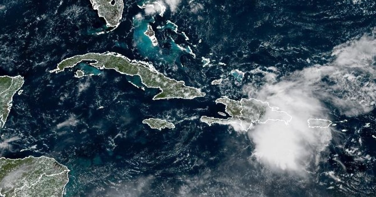
According to the statement, an active tropical wave located in the eastern Caribbean Sea, close to Hispaniola, is causing areas of showers and storms that are already affecting the Dominican Republic and Puerto Rico.
The system will move to the west-northwest and over the next 12 to 24 hours, it could organize into a broad area of low pressure near the Bahamas.
Although its evolution has not yet been determined, the proximity of this area of bad weather to Cuba, along with the high humidity over the region, will increase the chances of rainfall from Camagüey to Guantánamo.
The warning states that starting this Friday, the 26th, and throughout the weekend, numerous showers and thunderstorms are expected in those provinces, with rainfall that may be heavy and intense in some areas.
INSMET emphasized that a new special report will be issued if necessary and urged the public to stay attentive to official information during the hurricane season.
The National Hurricane Center (NHC) issued a notice this Thursday regarding an update on the cyclonic system "Humberto", which has already reached the category of tropical storm over the open waters of the Atlantic.
At the same time, meteorologists are closely monitoring another tropical wave in the central Caribbean that could become the next named storm, "Imelda," with the potential to affect eastern Cuba and several Caribbean nations in the coming days.
The National Hurricane Center of the United States (NHC) alerted on Facebook that the tropical disturbance identified as AL94 has a high probability of developing into a depression in one or two days near the Bahamas, necessitating close monitoring of its progression.
The agency warned that heavy rains are expected in the Virgin Islands, Puerto Rico, the Dominican Republic, Haiti, the Turks and Caicos, and the southeastern Bahamas over the next 48 hours.
Additionally, he urged the population of central and northwestern Bahamas, as well as the southeastern United States, to remain vigilant about the system's path, which could pass near Florida early next week.
The NHC noted that, although there is considerable uncertainty regarding the intensity and path of the disturbance, the chances are increasing that the southeastern United States will experience impacts from rain, wind, and storm surge.
To improve the accuracy of the models, NOAA and the Air Force will deploy reconnaissance flights over the next few days, in addition to conducting additional weather balloon launches in the eastern United States.
Frequently Asked Questions about the Threat of Tropical Waves and Storms in Cuba
Which areas of Cuba will be most affected by the tropical wave?
The provinces from Camagüey to Guantánamo in eastern Cuba are the ones presenting the highest risk of being affected by heavy rains and thunderstorms due to the tropical wave. It is expected that these weather conditions will persist throughout the weekend, increasing the likelihood of strong and intense precipitation in some areas.
What is the forecast for the development of tropical storm "Humberto"?
The National Hurricane Center has reported that tropical storm Humberto will strengthen in the coming days as it moves through the central Atlantic. Although there are currently no active coastal alerts, winds with tropical storm force could extend up to 165 kilometers from its center.
Is there a threat of a new storm named "Imelda" for Cuba?
Yes, meteorologists are monitoring a tropical wave in the central Caribbean that could develop into the storm "Imelda". There is a possibility that this storm could impact eastern Cuba and several Caribbean nations in the coming days, so it is advisable to stay tuned for updates from official agencies.
What measures should citizens take in response to the arrival of these storms?
The Meteorological Institute of Cuba has advised the public to stay informed through official accounts and to pay attention to communications from INSMET and NHC. It is crucial to follow the instructions of local authorities, especially in areas prone to flooding and landslides, and to prepare emergency kits in case of evacuations.
Filed under: