
Related videos:
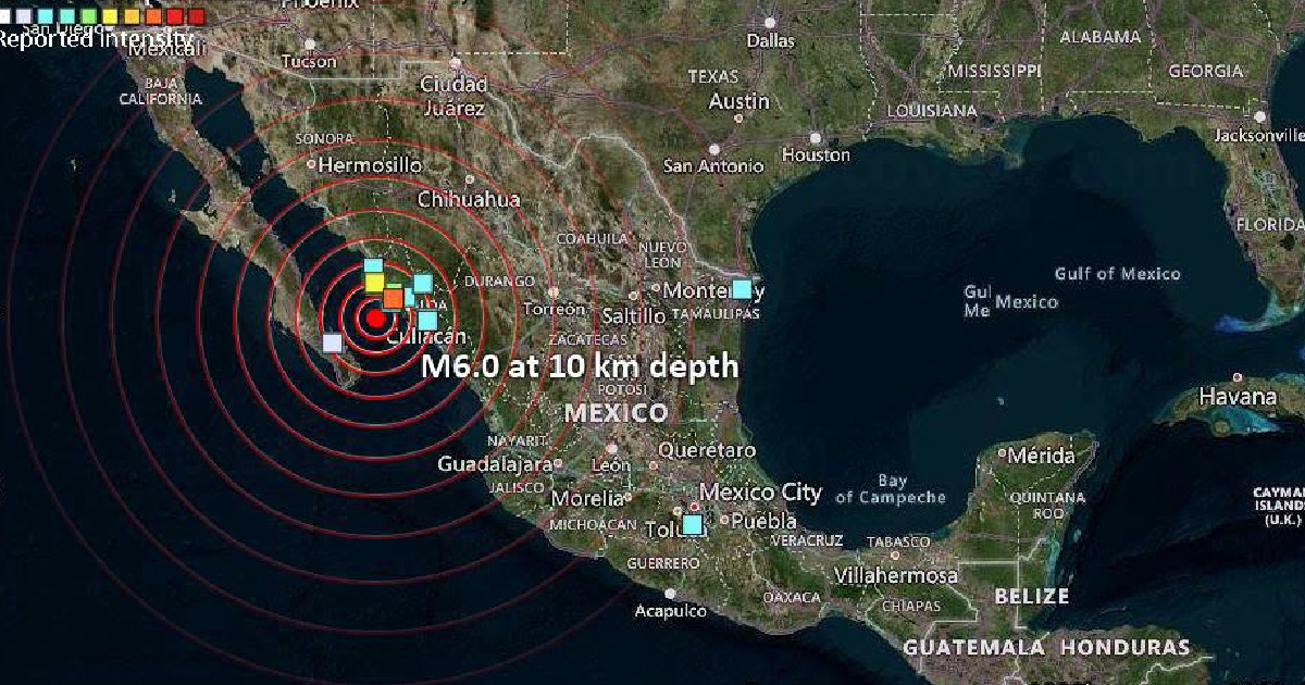
A magnitude 6.0 earthquake shook the Gulf of California this Tuesday, with its epicenter located approximately 75 kilometers southwest of El Progreso, Mexico, at a depth of 10 kilometers, classifying it as a shallow quake, as confirmed by the United States Geological Survey (USGS).
The earthquake occurred at 1:45 p.m. mountain time (3:45 p.m. Cuba time). The National Seismological Service of Mexico (SSN) recorded the event with a slightly higher magnitude of 6.1, and pinpointed the epicenter 116 kilometers southwest of Guasave, Sinaloa.
Through the State Coordination of Civil Protection, Mexican authorities reported that the earthquake did not cause any material damage or injuries.
In a report on the social media platform X, the civil protection agency stated that the earthquake was strongly felt by the population of Guasave and moderately by residents of Culiacán. Evacuations of public buildings were carried out in both locations in the state of Sinaloa, but no damages were reported.
In other areas of the municipalities of Los Mochis, Guasave, Culiacán, and the capital of the state of Sinaloa, as well as in the state of Baja California Sur, it was felt lightly, and preliminary protocols and evacuations were also activated.
The USGS updated the information regarding the intensity of the movement at 2:02 p.m. Mountain Time, and data on possible aftershocks was processed at 2:31 p.m. Specialists warned that the magnitude could be revised: "As seismologists review the available information, they may modify the reported magnitude of the earthquake," indicated the newspaper The New York Times.
Updated report from the National Seismological Service of Mexico
The SSN issued a special report in which it informed that, as of 3:00 pm (local time), 10 aftershocks of the earthquake that occurred in Guasave had been recorded, the largest being of magnitude 5.5.
"When a significant earthquake occurs, the rocks near the rupture zone undergo a rearrangement, resulting in a series of tremors in the area known as aftershocks. The number of aftershocks can vary from just a few to hundreds of events in the days or weeks following the main tremor," the entity warned.
The Gulf of California is one of the most seismically active areas in Mexico. Its behavior is determined by the system of transform faults that marks the boundary between the Pacific and North American tectonic plates, an extension of the San Andreas fault system. The Baja California Peninsula is moving northwest at a rate of approximately 50 millimeters per year relative to the Pacific plate.
The transform faults located between the Delfín and Carmen basins account for 60% of the earthquakes with a magnitude of 6.0 or greater at that plate boundary. The southern Gulf of California records an average of 18 earthquakes each year, with magnitudes ranging from 2.9 to 7.0.
This earthquake is the most intense recorded in the area so far in 2026, a year in which no prior event in the Gulf of California had exceeded magnitude 4.4. Among the most recent events in the region is a magnitude 7.6 earthquake that shook Mexico in September 2022.
The largest earthquake recorded in the Gulf of California since 1973 reached a magnitude of 7.0 on June 18, 1988. Other significant events in the area include two earthquakes with a magnitude of 6.7: one on January 4, 2006, 87 kilometers northeast of Santa Rosalía, Baja California Sur, and the other on September 13, 2015, 105 kilometers southwest of Los Mochis, Sinaloa.
The earthquake in the Gulf of California, Mexico, occurs less than a week after the two devastating earthquakes that shook Venezuela on June 24, with a tragic toll: 1,943 fatalities and 10,571 injured, according to official figures released on Tuesday by the Venezuelan government.
Filed under: