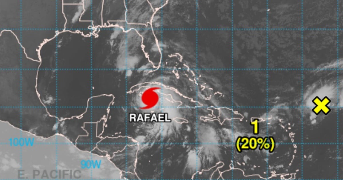
The Institute of Meteorology (INSMET) warned in its 6:00 a.m. bulletin on Wednesday (local time) that the weather situation in Cuba will deteriorate rapidly in the coming hours.
During the early hours, heavy rainfall, showers, and thunderstorms have been reported in the eastern and central regions, with an expected increase in the western area.
These rainfall will continue over the next 24 hours, with totals ranging from 100 to 200 millimeters, and potentially exceeding this in some areas.
In the morning, winds will be from the east to southeast in the west and center, reaching speeds of between 50 and 65 km/h.
Starting in the afternoon, winds will shift to the southeast-south, with speeds between 95 and 110 km/h and higher gusts. In areas near the center of this tropical system, winds will reach hurricane strength as they cross the western region.
Strong waves are anticipated along the central and western southern coast, with moderate to severe coastal flooding expected in the southern areas of Sancti Spíritus, Cienfuegos, Matanzas, Mayabeque, Artemisa, and Pinar del Río, as well as in the Isle of Youth and the Canarreos archipelago.
In a more recent publication, INSMET reported that Rafael reached Category 2.
At 7:00 a.m., the eye of the hurricane was located 140 kilometers east-southeast of the Isle of Youth and 260 kilometers southeast of Havana, Cuba, with sustained maximum winds of 160 km/h, moving northwest at 22 km/h.
If it continues on its current path of rapid intensification, it could reach Category 3 before making landfall.
Various Cuban meteorologists have made several posts on social media urging the population in the western region of the country to prepare. It is expected that Rafael will make landfall at some point between Artemisa and Pinar del Río.
Very recent reports from some weather radars reveal that the situation is becoming more complicated for the western region of the country.
What do you think?
COMMENTFiled under: