
Hurricane Beryl, which in the last few hours downgraded from category 4 to 3, is heading towards the Leeward Islands with sustained winds of 195 km/h and dangerous storm surges expected to begin in that region on Monday morning.
Despite having weakened its strength, Beryl continues to be a powerful hurricane.
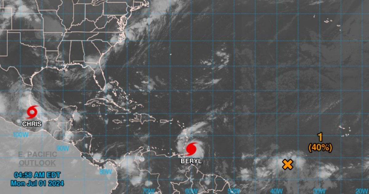
In the latest bulletin from the National Hurricane Center (NHC), the hurricane was located about 200 kilometers east-southwest of Grenada and 225 km southeast of Saint Vincent, moving west at 31 km/h with a minimum central pressure of 28.50 inches.
The current alerts and warnings include a hurricane warning for Barbados, Saint Lucia, Saint Vincent and the Grenadines, Grenada, and Tobago.
Additionally, Martinique and Trinidad remain under tropical storm warning, as well as Dominica, the southern coast of the Dominican Republic from Punta Palenque westward to the border with Haiti, and the southern coast of Haiti from the border with the Dominican Republic to Anse d'Hainault.
In the likely trajectory map of the meteorological phenomenon, Cuba is not currently included.
Hurricane conditions are expected in the areas under warning since this morning, with potential catastrophic damage in the Windward Islands, especially in Saint Vincent and the Grenadines and Grenada.
A potentially deadly storm surge could raise water levels up to 6 to 9 feet above normal tide levels in areas with onshore winds near the hurricane's eye.
Beryl can produce rainfall of 3 to 6 inches in Barbados and the Windward Islands, with localized maximums of up to 10 inches in the Grenadines and Grenada, causing possible flash flooding.
Additionally, large swells generated by Beryl will affect the Windward Islands and the southern Leeward Islands, as well as the southern coasts of Puerto Rico and Hispaniola, creating dangerous surf and currents.
Hurricane season in the Atlantic
Beryl formed on June 28 in the Atlantic and quickly gained strength. It has been the second named storm and the first hurricane of the current cyclone season, which is expected to be very active.
In recent days, the first tropical storm of the season, Alberto, made landfall in northeastern Mexico, where it caused intense rains that resulted in the death of four people.
On Sunday, June 30th, the tropical storm Chris formed in the Gulf of Mexico.
The National Oceanic and Atmospheric Administration of the United States predicted that the 2024 hurricane season will be well above average, with between 17 and 25 named storms.
Up to 13 hurricanes and four hurricanes of category 3 or higher are expected.
What do you think?
COMMENTFiled under: