
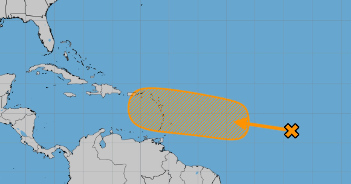
The National Hurricane Center (NHC) raised in its most recent update the possibility to 40% that a tropical wave located now in the central tropical Atlantic, which is moving westward, will develop into a tropical depression within a span of seven days.
The phenomenon, which is generating some disorganized rain and thunderstorms, is currently moving west at a speed of between 10 and 15 mph (16 and 24 km/h), approaching the Lesser Antilles.
In the provisional trajectory marked by the NHC graph, it can be seen that the tropical wave is moving toward Cuba.
It is expected that early next week this system may experience gradual development.
After approaching the Lesser Antilles, the system is expected to continue its trajectory toward the west-northwest, moving into portions of the eastern Caribbean Sea by the middle of next week.
The NHC warns that the development and evolution of this system should be closely monitored, especially by territories of the Lesser Antilles and in the eastern Caribbean regions.
The most active period of the current hurricane season began on August 20 and will last approximately six weeks.
This year, the hurricane season in the Atlantic, which runs from June 1 to November 30, has been considered very active.
In fact, experts rank it as the most active of the last three decades due to very favorable conditions for storm development, such as warmer sea temperatures and a reduction in vertical wind shear.
In an average season, 14 named storms, seven hurricanes, and three hurricanes of category 3 or higher typically develop, but the 2024 season could exceed those numbers.
Just two weeks ago, with the peak of the season approaching, the National Oceanic and Atmospheric Administration (NOAA) of the United States adjusted its forecast.
The new report shows a slight but significant adjustment in NOAA's forecasts, estimating a range of 17 to 24 named storms (winds of 39 mph or greater) and 8 to 13 hurricanes (winds of 74 mph or greater).
In the case of Cuba, Dr. Miriam Teresita Llanes Monteagudo, head of the Forecasting Center of the Meteorological Institute of Cuba, noted that the 2024 hurricane season will be very active in the northern Atlantic basin, which also includes the Gulf of Mexico and the Caribbean Sea, reported the official Cubadebate.
In this regard, it was pointed out that for the rest of the season, the formation of 15 tropical storms is expected across that entire geographical area, nine of which could reach hurricane status.
Of the total tropical storms, 12 are expected to develop in the oceanic area of the Atlantic and three in the Caribbean Sea, indicating that there are very high probabilities of at least one hurricane originating and intensifying in the Caribbean (85%) and of one coming from the Atlantic entering the Caribbean (70%).
What do you think?
COMMENTFiled under: