
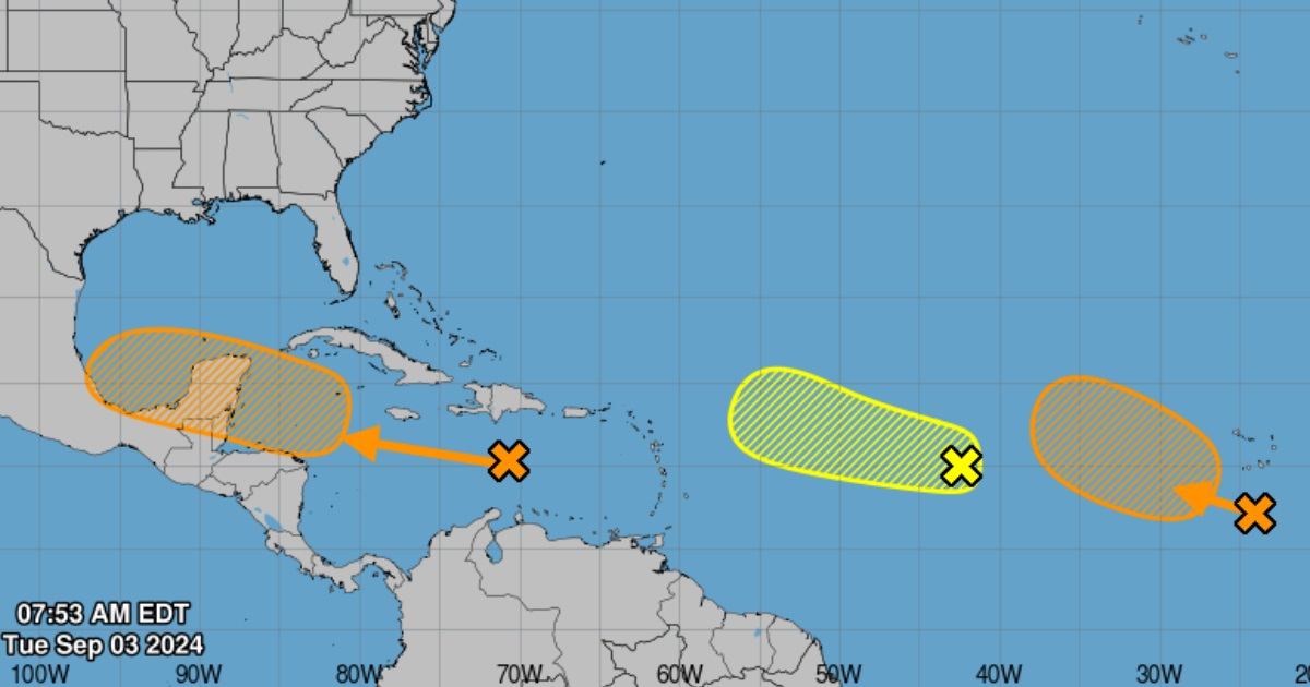
The National Hurricane Center (NHC) is monitoring the development of three tropical waves that have the potential to become tropical depressions in the Atlantic area in the coming days.
Meteorologists are monitoring the three phenomena due to favorable conditions in the area for the strengthening of upcoming cyclonic systems.
The first of these tropical waves is located in the central Atlantic. The NHC, which gives it a 40% chance of development, has stated that this system has the right conditions to evolve into a tropical depression throughout the week.
There is another tropical wave being monitored in the eastern Atlantic, where it is producing a broad area of rain and storms. The NHC estimates that there is a moderate probability of this system becoming a tropical cyclone in the next seven days; although its attention is not diminished, it should be noted that it could intensify and eventually impact more densely populated areas as it moves through key regions.
The third interest system is located near the Texas coast and continues to show low-pressure conditions, with a slow development potential if it remains at sea. NHC meteorologists noted that while significant development is not expected by Tuesday, it is important to keep monitoring possible changes in its formation and impact on coastal areas.
In August and September is when the most severe impacts of hurricanes and tropical storms are historically recorded, which is why alerts are issued by the NHC.
In fact, at the beginning of August, the National Oceanic and Atmospheric Administration (NOAA) adjusted its cyclone forecast for this season, which confirms that up to 13 cyclones could form.
The new report reflects a slight adjustment in NOAA's forecasts, which predict a range of 17 to 24 named storms (winds of 39 mph or greater) and between 8 to 13 hurricanes (winds of 74 mph or greater).
Of these, between 4 and 7 could reach great intensity, with winds of 111 mph or greater.
The main modification compared to the initial forecast from May is the reduction in the total number of named storms expected, which has decreased from 25 to 24.
What do you think?
COMMENTFiled under: