
Hurricane Milton, now a category 4, has consolidated as an extremely dangerous threat to the Florida peninsula as it moves northeast, after passing near the Yucatán Peninsula, Mexico.
With sustained winds of up to 155 mph (250 km/h), and even stronger gusts, Milton represents a serious threat to life and property along the west coast of Florida, where it is expected to make landfall on the night of this Wednesday.
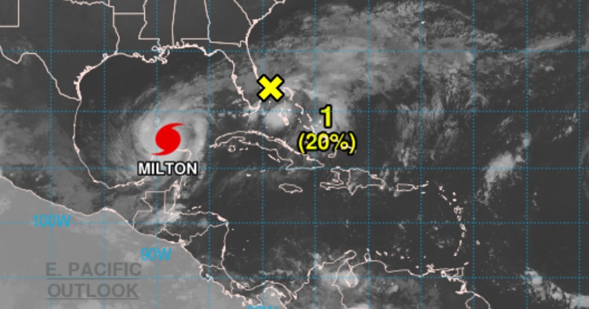
At 4:00 a.m. CDT, the eye of Hurricane Milton was located about 140 km northeast of Progreso, Mexico, and 905 km southwest of Tampa, Florida.
The hurricane is moving east-northeast at 19 km/h and is expected to continue on this path, approaching the west coast of Florida by October 9, where it could make landfall as a major intensity hurricane.
The Miami Weather Service has warned about the strength of the winds, rains, and storm surges that will hit the state.
Current Alerts and Warnings
Cyclonic Swell:
A storm surge warning has been issued for the west coast of Florida, from Flamingo to the Suwannee River, including Tampa Bay and Charlotte Harbor.
It is forecast that the water level may rise up to 15 feet in some areas, which poses a deadly danger. Residents in these areas must follow the evacuation instructions from local authorities immediately.
Hurricane Warning:
In effect for the west coast of Florida, from Bonita Beach to the mouth of the Suwannee River. Authorities warn that hurricane conditions, with winds exceeding 155 mph, may begin to be felt starting Wednesday afternoon.
Tropical Storm Warning:
It covers the entire Florida Keys region, Lake Okeechobee, and some areas of Florida's east coast, where tropical storm-force winds are expected starting on Wednesday morning.
Cyclonic swells and torrential rains
The coastal areas near Milton's path could experience severe flooding due to the rise in sea level combined with large waves. The most affected areas could see water levels rise between 10 and 15 feet above ground level in Tampa Bay and nearby areas such as Englewood and Bonita Beach.
It is forecasted that Milton will bring between 5 and 12 inches of rain to the Florida Peninsula, with localized accumulations of up to 18 inches in the most affected areas. This will lead to dangerous flash flooding and potential river overflows.
Destructive Winds:
Hurricane-force winds are expected on the west coast of Florida starting Wednesday afternoon. The winds may cause severe damage to structures, trees, and power lines. Tropical storm conditions will affect other areas of Florida, Georgia, and South Carolina.
Waves and Undertow:
The rip currents and waves generated by Milton will affect much of the Gulf Coast in the next 48 hours, increasing the risks of drowning in coastal areas.
Authorities urge residents in the areas under warning to complete their preparations immediately. The time to evacuate is running out quickly, and it is crucial to follow the orders of local officials to protect life and property.
The storm surge, hurricane-force winds, and flash floods can represent a deadly combination, so they should not be taken lightly.
Hurricane Milton is an extremely dangerous weather phenomenon that could cause devastating damage in Florida. The combination of hurricane-force winds, storm surge, and torrential rains makes Milton a critical threat.
The authorities ask the population to stay alert to weather reports and to follow the instructions of the emergency teams.
What do you think?
COMMENTFiled under: