
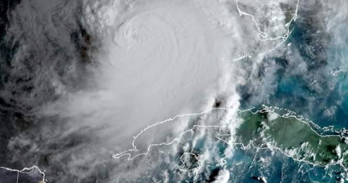
Hurricane Milton has generated adverse conditions in the western part of Cuba in recent hours as it approaches Florida, where the powerful phenomenon is expected to make landfall tonight or early Thursday morning.
Milton, where it has mainly left gusts of winds, strong swells, and intermittent showers associated with the hurricane's feeder bands.
A recent report from Tele Pinar mentioned that spiral bands continue to form over the western region, according to the La Bajada radar.
The Tropical Cyclone Warning No. 9 issued by the Meteorological Institute at 6:00 a.m. today specified that in Pinar del Río and Havana, winds from the south have been reported at speeds between 40 and 50 kilometers per hour.
Winds of up to 82 km/h have been recorded in La Palma, Pinar del Río; and 72 km/h in Casablanca, Havana.
It is expected that these winds will persist for the next 12 to 24 hours, extending from Pinar del Río to Mayabeque.
Swells and Coastal Flooding
In addition to the strong winds, the southern Cuban coasts are experiencing intense swells.
From Pinar del Río to Mayabeque, including the Isle of Youth and the Canarreos archipelago, coastal flooding is forecasted to be light to moderate.
In the coming hours, the Havana seawall will also begin to feel the impact of the swells.
Rains and Thunderstorms
The passage of the feeder bands associated with Milton has generated rain and thunderstorms in several locations in western Cuba.
Although these rains have not been continuous, they could intensify throughout the day, affecting some areas with heavy showers.
Cuban meteorological authorities will continue to closely monitor the evolution of Milton as it moves through the Gulf of Mexico and approaches the west coast of Florida.
With maximum sustained winds that, according to the latest report from the National Hurricane Center, are now 250 km/h, with higher gusts, the powerful cyclone is moving northeast at a speed of 26 km/h, located about 300 kilometers north of Cape San Antonio.
What do you think?
COMMENTFiled under: