
Related videos:
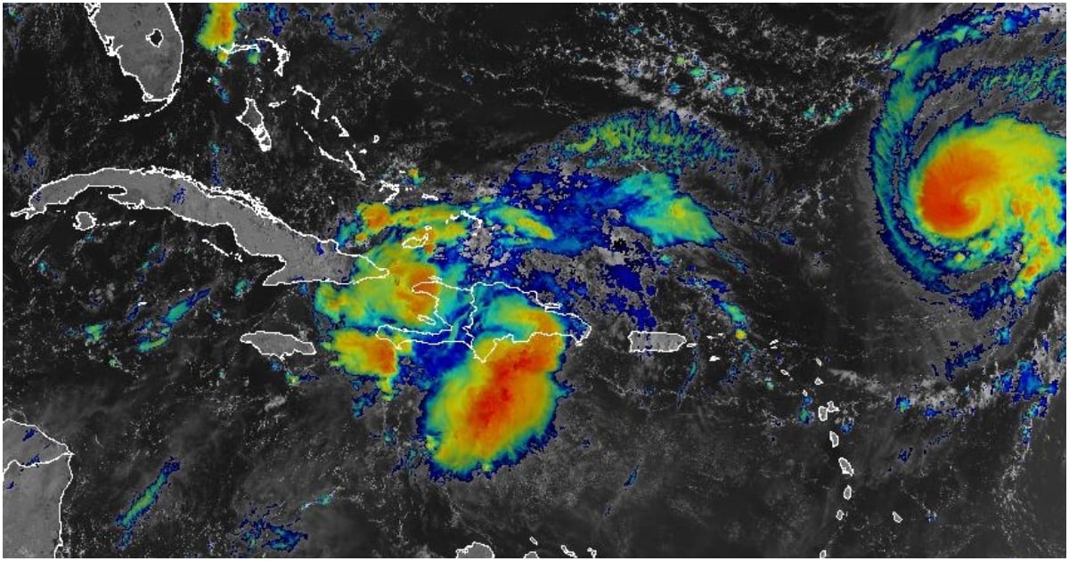
A tropical wave associated with an area of low pressure, identified as system #94L, is currently located near the eastern part of Cuba and the Turks Islands, and continues to show signs of organization, according to reports from the National Forecast Center of the Institute of Meteorology (Insmet) and the National Weather Service of the United States.
According to specialists, this system has a high probability of developing into a tropical depression within the next 24 to 48 hours as it moves northwest over the southwestern Atlantic waters.
"The system could gradually intensify as it moves toward the center and northwest of the Bahamas", warned the National Hurricane Center (NHC), which also alerted about possible effects of wind, heavy rainfall, and storm surges in areas of the southeastern United States early next week.
In Cuba, Insmet noted that the tropical wave is interacting with local and orographic factors, which has spurred the occurrence of showers, rains, and thunderstorms in the eastern region of the country this Thursday, some of which could be strong in certain areas.
While there is still uncertainty regarding the trajectory and intensity of the system, meteorological authorities do not rule out the possibility of issuing advisories about a potential cyclone or even alerts for some areas of the Bahamas in the coming hours, depending on its evolution.
The Hurricane Humberto, which remains active in the Atlantic, continues to strengthen and is expected to become a major hurricane in the coming hours. However, its current path takes it away from the east coast of the United States, although the risk of rip currents persists.
It is recommended that the Cuban population carefully follow the official weather reports issued by Insmet and avoid spreading rumors or unconfirmed information.
Filed under: