
Related videos:
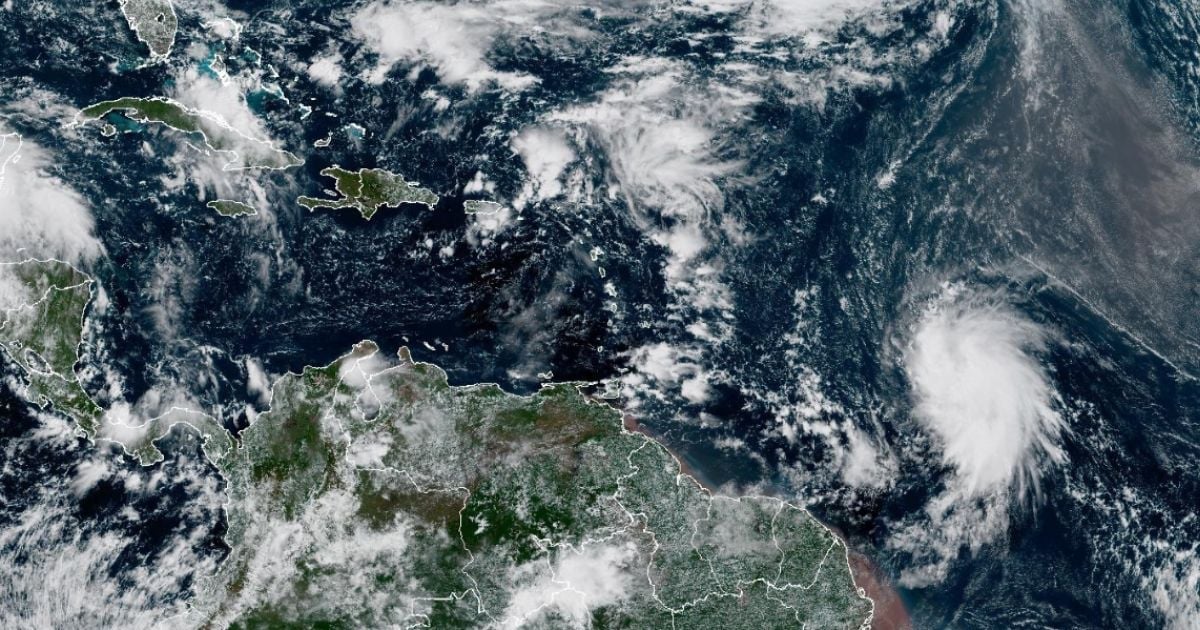
Tropical storm Jerry formed this Tuesday in the central Atlantic and became the tenth named storm of the 2025 hurricane season, according to the National Hurricane Center (NHC).
In its first official part, issued at 11:00 a.m. (Atlantic time), the NHC reported that Jerry has maximum sustained winds of 65 km/h and is moving west-northwest at a speed of 37 km/h.
The system is located east of the Lesser Antilles and, according to the forecast, it could pass near or just north of the northern group of those islands between Thursday night and Friday.
Authorities warn of possible impacts from winds, heavy rain, and strong waves in that region.
Although no formal warnings have been issued yet, the NHC indicated that advisories could be activated later this Tuesday or in the evening, depending on the system's evolution.
The meteorological agency also noted that, because the center of the storm is over open water, dangerous conditions could extend beyond the expected area.
He urged residents of the Eastern Caribbean islands to closely monitor the development of Jerry.
With Jerry, there are now ten systems named in the current Atlantic hurricane season, which has been particularly active in 2025.
This Monday, the NHC warned that a low-pressure area in the Atlantic had a high likelihood of becoming a tropical cyclone in the coming days.
At that moment, specialists warned that the area, with an 80% chance of development, would be approaching the northern part of the Windward Islands between Thursday and Friday.
The arrival of October keeps Cuban meteorologists on alert due to the high risk of tropical cyclone formation in the region.
Although the climatic peak of the hurricane season typically occurs in September, the tenth month of the year also poses a significant threat to Cuba.
From the Provincial Meteorological Center of Ciego de Ávila, specialist R. Galardy warned that October is historically one of the most dangerous months for the island, especially for the western Caribbean Sea and the Gulf of Mexico.
Frequently Asked Questions about Tropical Storm Jerry and the 2025 Hurricane Season
What characteristics does Tropical Storm Jerry have?
Tropical storm Jerry has maximum sustained winds of 65 km/h and is moving west-northwest at a speed of 37 km/h. It is located east of the Lesser Antilles and may pass near or just north of these islands between Thursday night and Friday.
What is the general forecast for the 2025 hurricane season in the Atlantic?
The forecast for the 2025 hurricane season in the Atlantic indicates above-average activity, with between 13 and 19 named storms and 6 to 10 hurricanes. It is expected that between 3 and 5 of these hurricanes could reach major intensity (Category 3 to 5).
What are the risks associated with Tropical Storm Jerry?
The risks associated with tropical storm Jerry include strong winds, heavy rainfall, and high surf in the Lesser Antilles region. Although no formal warnings have been issued at this time, watches could be activated depending on the evolution of the system.
Why is the 2025 hurricane season considered active?
The 2025 hurricane season is considered active due to the warming of the Atlantic Ocean and the likely absence of the El Niño phenomenon, which usually helps weaken cyclones. These conditions favor the formation of tropical cyclones.
How should the islands of the Caribbean prepare for Tropical Storm Jerry?
The Caribbean islands must closely follow the official updates from the National Hurricane Center and stay informed about the development of Tropical Storm Jerry to take necessary precautionary measures. Early preparation is key to minimizing risks.
Filed under: