The hurricane Melissa, a category 5 on the Saffir-Simpson scale, made landfall this Tuesday along the southern coast of Jamaica with sustained maximum winds of 295 kilometers per hour and gusts exceeding 300 km/h, according to meteorologist Ailyn Caridad Jústiz Águila in the Noon News program of Televisión Cubana.
The specialist confirmed that Melissa is now the third most powerful hurricane in the history of the Atlantic, considering its central pressure of 892 hectopascals (hPa). The system is moving north-northeast at 15 km/h and is currently about 205 kilometers south of Granma province, in eastern Cuba.
Rains, winds, and deterioration of conditions in Cuba
Jústiz Águila explained that the rain bands of the cyclone are already affecting eastern Cuba, with accumulations of over 400 millimeters of precipitation in some areas.
"The weather conditions are beginning to deteriorate across the eastern part of the country," he warned, while alerting that the hurricane has a wide influence area of 315 kilometers from its center, posing a danger to the entire eastern region.
The eye of the hurricane, with an estimated diameter of 20 to 25 kilometers, is moving over Jamaican territory, while the outer bands of rain and winds are already spreading over Santiago de Cuba, Guantánamo, and Holguín.
It could maintain its extreme strength before hitting Cuba
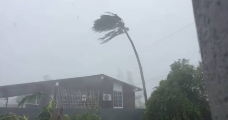
The television report specified that Melissa struck the narrowest and lowest part of Jamaica, which will allow it to lose less intensity than previously anticipated before reaching Cuba.
According to forecasts, the hurricane will make landfall in Cuba early Wednesday morning on the southern coast, although the exact entry and exit points on the northern coast are still being assessed.
"When it moves north of Jamaica, we will know more precisely its final trajectory and the intensity with which it could strike Cuba," the meteorologist noted.
The phenomenon retains an extreme destructive potential, with torrential rains, storm surges, and hurricane-force winds capable of causing severe structural damage.
Meteorological and civil defense authorities have maintained the state of alert for the eastern part of the country, while evacuations in the most vulnerable areas are being intensified.
Filed under: