
Related videos:
The National Hurricane Center (NHC) of the United States extended the hurricane alert to the Cuban provinces of Las Tunas and Camagüey, while the hurricane Melissa, a category 5 storm, is hitting the southern coast of Jamaica with catastrophic force.
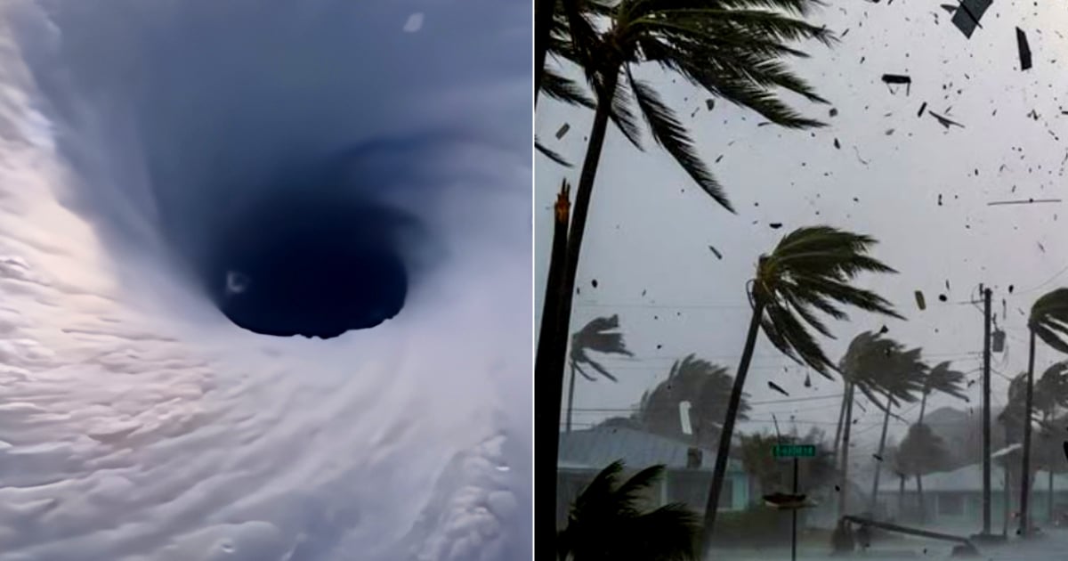
With sustained winds of 295 km/h (185 mph) and a minimum central pressure of 892 millibars, Melissa remains an extremely dangerous cyclone.
Its eye was located at 11:00 AM (Eastern Time) at coordinates 17.9N 77.9W, 60 kilometers southeast of Negril, moving toward the north-northeast at 15 km/h.
“Catastrophic winds, flash flooding, and storm surge are occurring on the island,” warned the NHC in its latest report.
Cuba enters the danger zone
The Cuban government, in coordination with the NHC, activated a hurricane warning for the provinces of Granma, Santiago de Cuba, Guantánamo, Holguín, and Las Tunas, and a tropical storm warning for Camagüey.
United States meteorologists forecast that Melissa will cross the southeast of Cuba early Wednesday, primarily affecting the eastern provinces, before continuing toward the southeast and central Bahamas, which are also under hurricane warning.
"Hurricane conditions are expected in Jamaica over the coming hours, in eastern Cuba tonight, and in the Bahamas on Wednesday," reported the NHC.
Catastrophic blow in Jamaica
The eye of the hurricane is now making landfall in the west of Jamaica, and local authorities are reporting destructive winds, torrential rains, and extreme waves.
The NHC warns that winds could be up to 30% stronger in mountainous areas, and reminded the public not to go out during the passage of the eye, as the rear wall of the system causes a sudden return of violent gusts.
Weather conditions are rapidly deteriorating in the south and west of the island, with an extreme risk of flooding and landslides.
Historic swells and flooding
The southern coast of Jamaica is facing a potentially deadly storm surge, with sea levels that could reach between 9 and 13 feet (up to 4 meters) above ground level, accompanied by large and destructive waves.
In the northwest, near Montego Bay, sea level rises of 2 to 4 feet (about one meter) are expected.
The rains associated with Melissa will total between 15 and 30 inches (38 to 76 cm) in Jamaica, with local maxima of up to 40 inches (100 cm).
In eastern Cuba, accumulations of 25 to 50 cm are expected, with maximums of 63 cm, which could lead to flash flooding and numerous landslides.
Threat to the Cuban East
The eastern provinces of Cuba are beginning to feel the indirect effects of the hurricane, with increased winds and rain starting in the afternoon.
Cuban authorities recommend securing windows and roofs, staying away from trees and unstable structures, and remaining vigilant to official notices.
The slow advance of the system will prolong dangerous conditions, especially in low coastal areas of southern Granma, Santiago de Cuba, and Guantánamo, where swells of 8 to 12 feet (2.5 to 3.5 meters) could be recorded.
Expected trajectory
According to the NHC, the eye of Melissa will fully cross Jamaica during the day, then move over southeastern Cuba in the early hours of Wednesday, and subsequently over the Bahamas the following day.
Although little change in intensity is expected before the full impact on Jamaica, the hurricane will remain a major system at least until Thursday as it moves toward the western Atlantic.
"Melissa will reach Cuba as an extremely dangerous hurricane and will still be very powerful as it moves over the Bahamas," the report specified.
Next bulletin
The National Hurricane Center will issue its next complete bulletin at 5:00 p.m. (Eastern Time), with new updates on the trajectory, intensity, and current alerts for the region.
Meanwhile, the authorities of Jamaica and Cuba are urging the population to stay in safe shelters and not to go out under any circumstances until conditions improve consistently.
Filed under: