
Related videos:
The Cuban meteorologist Yosmelvi Páez Cornell issued a warning this Sunday about the impact that the phenomenon El Niño will have in Cuba during the winter of 2026-2027, predicting a cold season characterized by heavy rains, tornadoes, and severe weather events.
According to the analysis published by Páez, the climate paradox is striking: "While we will experience one of the calmest hurricane seasons in decades due to the very strong effects of El Niño, the winter season will be just the opposite."
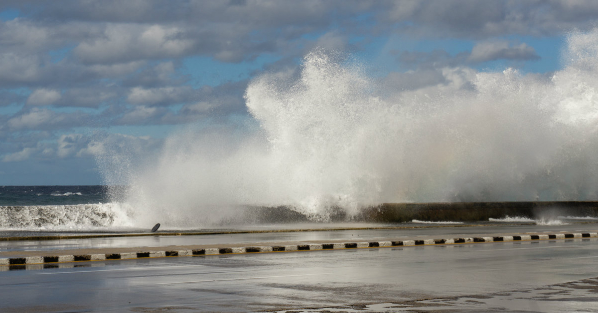
The specialist explains that El Niño modifies global atmospheric circulation in such a way that, between November and March, cold fronts from North America reach the Caribbean with greater frequency and intensity, increasing the occurrence of rain, showers, and thunderstorms over the island.
One of the most notable risks in the forecast are the so-called pre-frontal lines, storm systems that develop prior to the arrival of a cold front.
According to Páez, "these can produce heavy rains, intense winds, and even tornadoes, especially in the west and center of Cuba."
These factors are compounded by a more active subtropical jet stream, which encourages the formation of low-pressure systems over the Gulf of Mexico and the western Caribbean, along with an increased availability of moisture transported from both basins, leading to persistent rainfall and longer-lasting storms.
The expected outcome, according to the meteorologist, is a general increase in severe weather events: "During El Niño winters, the likelihood of severe local storms, isolated hailstorms, waterspouts, and some tornadoes increases."
The most recent historical precedent supports that warning. During the El Niño winter of 2009-2010, Cuba recorded seven cold fronts in February 2010, more than double the historical average of 3.34 for that month. The seasonal average of frontal systems on the island is 19.5, with a record of 35 during the 1976-1977 season.
The warning comes just ten days after the NOAA officially declared the El Niño phenomenon on June 11, 2026, with a 63% chance of reaching very strong intensity between November of this year and January 2027.
Temperature anomalies in the Niño 3.4 region have already surpassed records from previous strong episodes, including those of 2015 and 1997.
That same phenomenon is what leads experts to anticipate a less active hurricane season for Cuba, with El Niño acting as a natural brake on the formation of hurricanes in the Atlantic by increasing wind shear.
However, the cyclonic calm does not mean there is no danger. Cuba is still dealing with the aftermath of the hurricane Melissa, which made landfall in the eastern part of the island on October 29, 2025, as a category 3 hurricane, causing damage to over 116,000 homes and affecting more than 3.5 million people in Santiago de Cuba, Holguín, Granma, Las Tunas, and Guantánamo.
The island is also facing an energy, food, and basic services crisis, which makes it especially vulnerable to new weather events.
A severe winter, with urban and coastal flooding, damage to agriculture, and additional power outages, would further worsen the living conditions of the population.
Ken Graham, director of the National Weather Service of NOAA, summarized the risk with a warning that applies to both the hurricane season and the approaching winter: "It only takes one storm for it to be a very bad season."
Filed under: