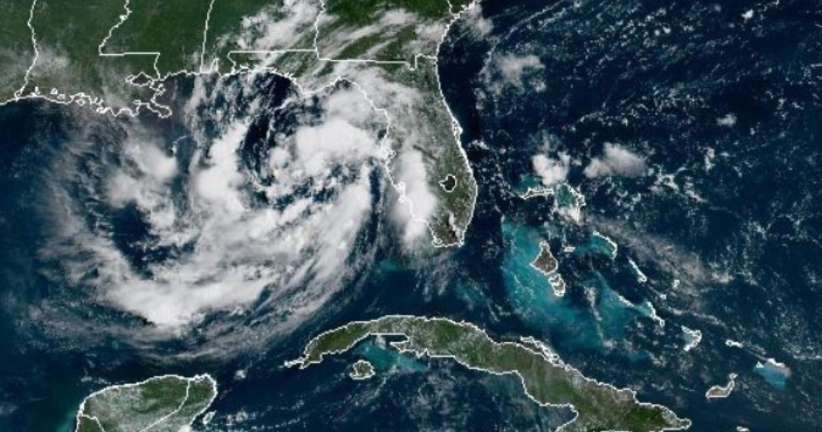
The National Hurricane Center (NHC) issued its first official advisory for Tropical Depression Two this Sunday, a system that formed in the northeastern Gulf of Mexico about 155 miles south of Panama City, Florida, and has already prompted the activation of a tropical storm watch for the coastal stretch of northwest Florida, from the Ochlockonee River to the Alabama border.
According to the NHC advisory number one, issued at 10:00 AM Central Time, the system was recording maximum sustained winds of 30 mph (45 km/h) with higher gusts and a minimum central pressure of 1,011 millibars.
His movement was extremely slow: barely two miles per hour in a north-northwest direction.
Tropical storm watch covers the coastal strip from the Ochlockonee River to the Alabama border, which includes a large part of the Panhandle of Florida.
The NHC specified that this category of alert means that "tropical storm conditions are possible within the watch area, in this case within the next 36 to 48 hours."
The agency forecasted that the depression will gradually intensify and is expected to reach tropical storm status this Sunday night or Monday, which would give it the name Bertha and make it the second named storm of the 2026 season.
The expected trajectory indicates that the system will advance slowly to the northwest or north-northwest for one or two days, before turning west and moving near the northern coast of the Gulf over the coming days.
The NHC warned that "additional watches may be needed in the next day or two."
Among the main identified dangers are the storm surge, with levels ranging from one to three feet from Indian Pass to Chassahowitzka, and the rainfall, which could accumulate between two to four inches in most of the affected area, with local totals of up to eight inches by Thursday along the eastern and central Gulf coast, from western Florida to parts of southern Alabama, Mississippi, and Louisiana.
The NHC warned that these rains could trigger flash flooding, especially in urban areas.
The system had been monitored since Wednesday, when it was identified as an area of low pressure with only a 20% chance of development.
On Saturday, with the system still lacking a defined circulation, the chances remained low, but by Sunday they rose to 80% before the NHC officially classified it as a tropical depression.
Since monitoring began, meteorologists anticipated that rainfall would be the main threat regardless of its classification.
The meteorologist Matt Devitt described it as a possible rain machine for Florida, while Alex DaSilva from AccuWeather noted that "warm waters can allow for rapid intensification and the forecast can evolve quickly."
The 2026 hurricane season is projected to be below the historical average: Colorado State University reduced its forecast in July to just nine named storms, four hurricanes, and one major hurricane for the entire year, partly due to the strengthening of El Niño.
If Tropical Depression Two becomes Bertha, it will be the second named system of the season, following Arthur, which impacted Texas and Louisiana in mid-June without reaching hurricane status.
Related videos:
Filed under: