
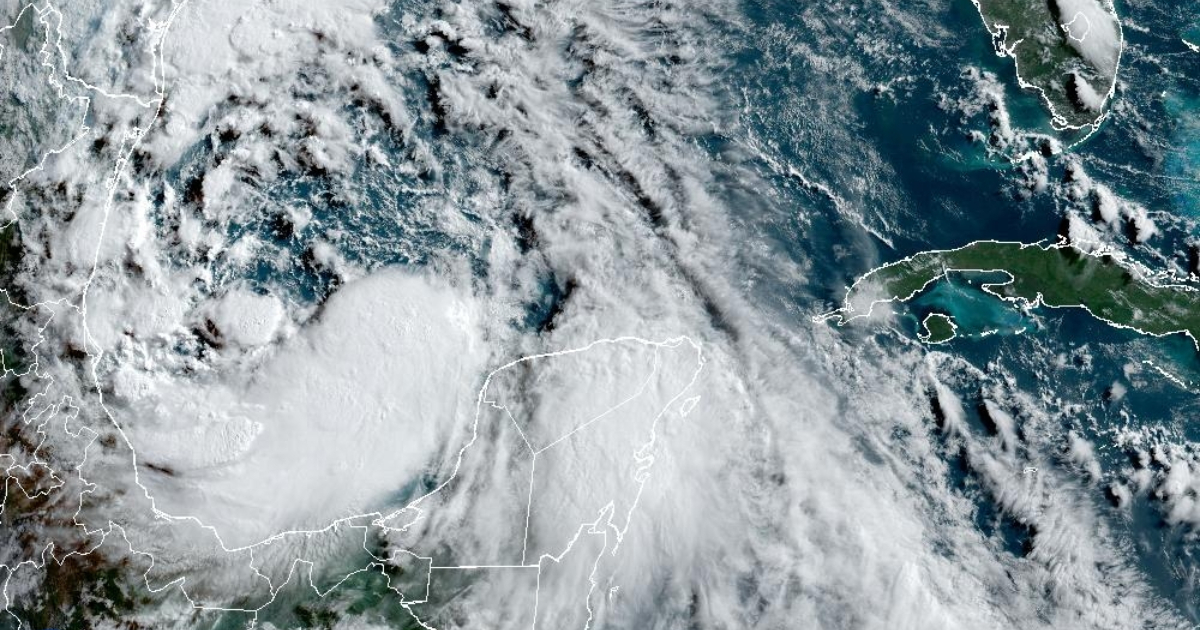
The potential first cyclone of the 2024 season is looming over the Gulf of Mexico in the form of a disturbance bringing heavy rains, coastal flooding, and gusty winds to the coasts of Texas and northeastern Mexico.
The system is moving slowly over the southwest of the Gulf of Mexico, maintaining a broad circulation with winds typical of a tropical storm, but distant from its central region.
According to the latest forecast from the National Hurricane Center (NHC), the center of the disturbance is located near 22.7 degrees North latitude and 93.8 degrees West longitude.
Currently moving west-northwest at 285 degrees at 7 knots (12.9 kilometers per hour). The estimated minimum central pressure is 998 mb and maximum sustained winds of 35 knots (64.8 km/h) are recorded, with gusts up to 45 knots (83.3 km/h).
The NHC indicated that a tropical storm warning has been issued for the coast of Texas, from El Paso de San Luis southward to the mouth of the Rio Grande, as well as for the northeast coast of Mexico, south of the mouth of the Rio Grande to the Port of Altamira.
It is forecasted that the system will reach the northeast coast of Mexico late tonight or early Thursday, as well as an increase in forward speed. The disturbance is expected to become a tropical storm by late afternoon or in the next few days (80% probability).
It is expected that the potential first tropical cyclone will produce rainfall totals of 5 to 10 inches across northeastern Mexico to southern Texas, with possible maximum totals of 15 inches. This rainfall will likely result in significant flash and urban flooding throughout the day, with new and renewed river rises. Landslides are also possible in higher terrain areas across northeastern Mexico," reported the NHC.
He also indicated that "the combination of a dangerous storm surge and the tide will cause flooding of normally dry areas near the coast, due to the increase in waters moving inland from the coast. The water could reach heights of two to four feet."
Regarding the wind, tropical storm conditions with the possible occurrence of tornadoes are expected today and tonight in parts of deep South Texas and southeast Texas.
In a notice published on its website, the NHC warned that it is a "large system with impacts that extend very far from the center in the form of rain, coastal flooding, and tropical storm conditions in parts of Texas and Mexico." If it develops into a cyclone, the disturbance would be named Alberto.
On June first, the 2024 Atlantic hurricane season officially began, with worrying forecasts that it will be the most active in the last 30 years.
The National Oceanic and Atmospheric Administration (NOAA) of the United States reminded that the hurricane season will extend from June 1st to November 30th.
While reporting that "the tropics will remain relatively calm for at least the next 7 days," at the end of May in its annual report prior to the start of the hurricane season, NOAA warned that the most active in the last three decades is expected, with between 17 and 25 storms with winds exceeding 62 kilometers per hour.
What do you think?
COMMENTFiled under: