
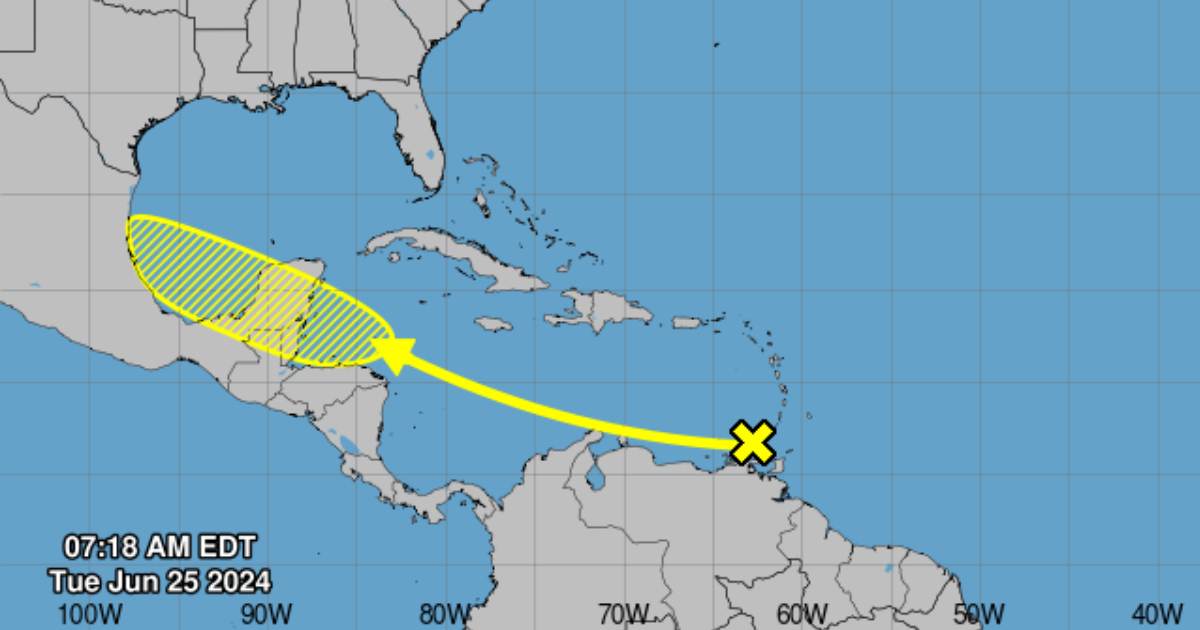
The National Hurricane Center (NHC) of the United States warned on Tuesday about a tropical wave that is producing rain and thunderstorms in the southeastern Caribbean Sea.
From its account on the social network X, the NHC predicts that the system has low chances of forming over the western Caribbean in the coming days or over the southwest Gulf of Mexico during the weekend.
The environmental conditions seem conducive for slow development once it reaches the western Caribbean by the end of this week. The formation probability within 48 hours is very low, close to zero percent, while it increases slightly if the forecast range extends up to seven days, as detailed on its website.
A few days ago, a similar atmospheric phenomenon hit Cuba, with heavy showers, rain, and thunderstorms, especially in the western and central regions of the country, where several areas were flooded.
Although it has already dissipated, the current hurricane season had its first tropical storm: Alberto, which formed in the western Gulf of Mexico and brought rains, coastal flooding, and gusty winds.
The National Oceanic and Atmospheric Administration (NOAA) of the United States forecasted a more active than usual season in the Atlantic, with the possibility of up to 13 hurricanes, of which up to seven could be of great intensity.
According to the annual forecast published by the entity every May, between June 1st and November 30th, between 17 and 25 storms with winds exceeding 62 kilometers per hour will form.
Rick Spinrad, administrator of NOAA, highlighted in a press conference that this forecast is the highest that the agency has issued in its regular May report because in a typical season between seven hurricanes and three major hurricanes with sustained maximum winds of 178 km/h or more are recorded.
The high expected activity in the Atlantic basin is attributed to a combination of factors favorable for the formation of storms, including warm ocean temperatures that are close to record levels in the Atlantic and the development of La Niña conditions in the Pacific.
What do you think?
COMMENTFiled under: