
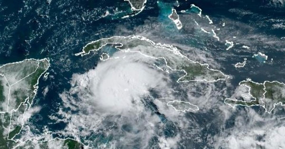
The Cuban Meteorology Institute (INSMET) revealed that during the passage of Hurricane Beryl along the seas south of Cuba this Thursday, the strength of the winds will increase in central and western Cuba.
Since this morning, the strength of the winds in central and western Cuba will increase, blowing at speeds between 20 and 35 km/h, reaching 40 km/h with higher gusts, mainly in the Isle of Youth and the western tip of Pinar del Río, INSMET warned in its Tropical Cyclone Advisory No. 10.
Regarding precipitation, in the central and western regions, "the outer rain bands will cause showers and rains at intervals, as well as some thunderstorms, which may be strong in some locations."
There will be strong swells in the seas south of the central and western regions, mainly in the south of the Canarreos archipelago, the Isle of Youth, and the western tip of Cuba, "with light coastal flooding in low-lying areas of this coastline."
In the case of the eastern provinces - where Beryl was most felt on Wednesday - a gradual decrease in the strength of the winds is expected, which will still be from the east with speeds between 25 and 40 km/h, with higher gusts.
In the eastern region, rain will also decrease during the morning of this July 4th, and in the afternoon there will only be isolated showers.
During the last few hours, Beryl has continued to weaken and now has maximum sustained winds of 195 km/h, with higher gusts, making it now a category three hurricane on the Saffir-Simpson scale, with a maximum of five.
Beryl maintains its fast west-northwest movement, with a translation speed of 31 km/h. Early on Thursday morning, the phenomenon passed by the Cayman Islands with strong winds and dangerous storm surges.
At dawn this Thursday, the first images of winds, rains, and some flooding on the islands have already been seen.
Then Beryl will emerge over the southwest of the Gulf of Mexico on Friday night and will turn northwest.
The approach of Beryl to the shores of Quintana Roo, in the Mexican Caribbean, is keeping emergency services and the general population on high alert while prevention programs are put in place, as the hurricane is heading directly towards a very touristic area.
What do you think?
SEE COMMENTS (1)Filed under: