
Related videos:
The tropical storm Erin has slightly increased its forward speed in the last few hours, although it maintains the same maximum sustained winds as yesterday, at 75 km/h (45 mph) with stronger gusts.
Erin is moving west at about 31 km/h, and it is expected to maintain this course until Thursday, before gradually turning west-northwest starting Thursday night and continuing through the weekend.
The NHCforeseesa gradual strengthening starting this Wednesday, with a high probability that Erin will reach hurricane status between Thursday afternoon and Friday morning.
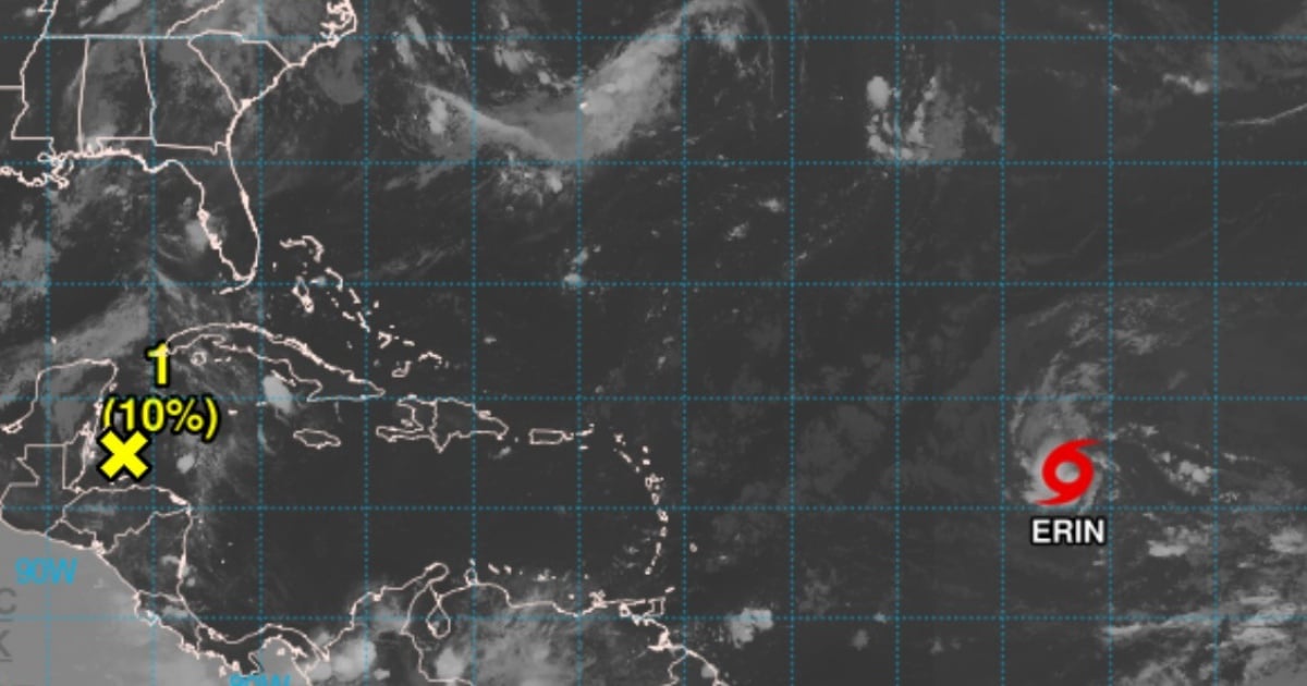
According to notice number 8 issued at 5:00 a.m. AST (Atlantic Standard Time) by the National Hurricane Center (NHC), the system was located at that time at a latitude of 16.5°N and a longitude of 41.9°W, approximately 2,255 kilometers east of the northern Lesser Antilles.
The forecast models indicate that, if it maintains its course, the center of Erin will pass near or just north of the Northern Windward Islands over the weekend.
Although no coastal alerts or advisories have been issued at this time, the NHC advises residents and authorities in the Northern Windward Islands, the Virgin Islands, and Puerto Rico to closely monitor the development of the system.
It maintains an estimated minimum central pressure of 1004 millibars. Winds with tropical storm force extend up to 95 km from the system's center.
Possible impacts
Although it is still too early to determine direct impacts in populated areas, the agency warns that the swells generated by Erin will begin to be felt in the Northern Leeward Islands, the Virgin Islands, and Puerto Rico over the weekend.
These waves could generate dangerous rip currents and adverse maritime conditions, so coastal residents and sailors are urged to consult local bulletins and follow civil protection recommendations.
The NHC insists that projections for trajectory and intensity may vary, making constant monitoring of the system crucial over the next 48 to 72 hours.
Erin is the fifth tropical storm of the current hurricane season. The storms Andrea, Barry, Chantal, and Dexter did not reach hurricane strength, dissipating before they could consolidate.
The Atlantic hurricane season officially began on June 1 and will last until November 30.
Meteorologists had warned that 2025 could be marked by the formation of highly intense and more frequent cyclones.
Filed under: