
Related videos:
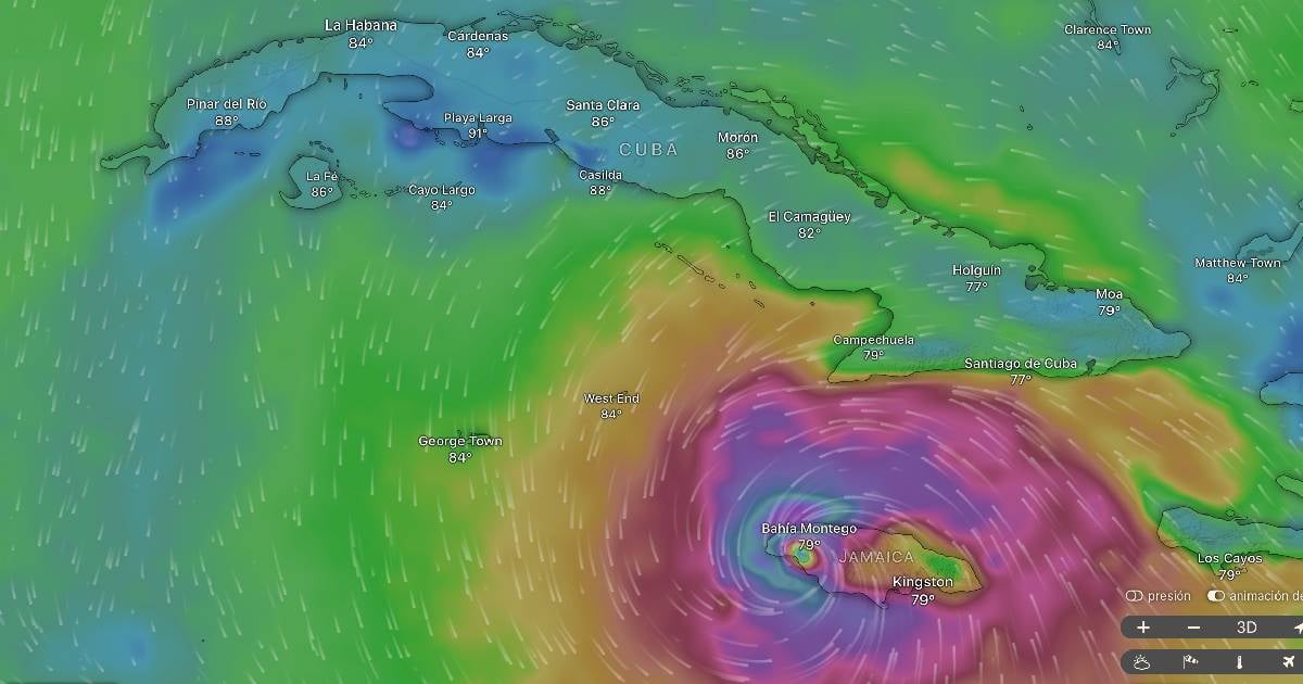
The independent global weather visualization platform Windy estimated this Tuesday that Hurricane Melissa will make landfall in the Uvero–Chivirico area, in Santiago de Cuba, during the early morning on Wednesday, with maximum winds close to 222 kilometers per hour.
A map from the specialized portal windy.com indicates that the powerful Hurricane Melissa, a category 5, is very close to the eastern region of Cuba and could make landfall at 7:00 a.m. on Wednesday in the area of Uvero–Chivirico, along the southern coast of Santiago de Cuba, where local authorities have begun to evacuate vulnerable communities.
For its part, the National Hurricane Center (NHC) warned that Melissa maintains maximum sustained winds of 222 kilometers per hour and continues to move toward the northeast, after leaving a trail of destruction in Jamaica.
"Intense rains, high waves, and destructive winds are expected in the eastern part of the country," the NHC report stated.
The eastern provinces of Cuba, especially Santiago de Cuba, Guantánamo, Granma, and Holguín, are under , due to the imminent impact of the system, which could cause coastal flooding, landslides, and severe damage to infrastructure.
"Hurricane Melissa poses an extreme danger to human life and homes. People should remain in safe places and not go out during the passage of the eye of the cyclone," reiterated the National Hurricane Center.
The weather phenomenon, which has caused devastation in the Caribbean, could maintain its intensity as it moves through eastern Cuba before continuing toward the southeast of the Bahamas.
Filed under: