The hurricane Melissa made landfall in Cuba during the early hours of Wednesday, October 29, unleashing its fury over several provinces in the eastern part of the country.
With sustained winds of 195 km/h, heavy rains, and dangerous swells, this powerful category 3 cyclone left in its wake a trail of destruction, flooding, and chaos in the municipalities of Santiago de Cuba, Granma, Guantánamo, Holguín, and Las Tunas.
Below are some images that reveal the impact of the meteorological phenomenon in each of those provinces.
Santiago de Cuba
The first strike of the hurricane occurred on the southern coast of Santiago de Cuba, at El Francés beach, in the municipality of Guamá, near Chivirico, at 3:10 a.m.
According to local reports, the city of Santiago and other municipalities in the area woke up to the visible damage caused by the cyclone.
Streets were completely flooded, roofs torn off by the winds, electric poles downed, and severe interruptions in the power supply were experienced.
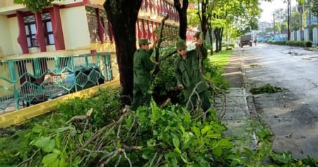
Another area heavily affected in Santiago de Cuba was the municipality Palma Soriano.
There are also severe damages in Baire, in Contramaestre.
Accumulated rainfall exceeds 250 mm in this province, and in the Sierra Maestra, values over 300 mm have been reported, which has significantly increased the risk of sudden flooding and landslides in the mountainous areas.
Granma
From Bayamo, the capital of Granma, the images broadcasted by CMKX Radio Bayamo and CNC TV Granma reflect the magnitude of the disaster.
The streets were turned into raging rivers, while power poles and trees were violently knocked down. In several videos, the water is seen completely covering the sidewalks in front of public buildings and homes in the historic center.
The wind and rain completely transformed the urban landscape, leaving a scene of devastation that will be hard to forget.
Las Tunas
Although to a lesser extent than in the neighboring provinces, Las Tunas also experienced some collapses, blown-off roofs, and fallen trees.
Guantanamo
Although the center of the hurricane did not pass directly over Guantánamo, its outer bands heavily battered the province.
The city of Baracoa experienced heavy rainfall, hurricane-force wind gusts, and power outages.
Fallen trees and flooding have been reported in several areas, while the population remains sheltered, waiting for safer conditions.
Holguín
The municipality of Sagua de Tánamo, in the province of Holguín, is among the most affected areas of that province following the passage of Hurricane Melissa.
The overflow of the Sagua River has caused severe flooding in several areas of the territory.
During the early hours of this Wednesday, users on social media shared shocking images and videos showing streets turned into rivers and homes partially submerged. Another municipality affected in Holguín is Cueto.
Neighbors report that the water has reached historic levels, flooding homes, businesses, and main roads.
Melissa is leaving Cuba
The National Hurricane Center (NHC) reported at 11:00 a.m. this Wednesday that Melissa is located off the eastern coast of Cuba, now in the southwestern Atlantic, with a central pressure of 974 mb and moving northeast (35°) at 14 mph (22 km/h), and will continue to bring heavy rain and high surf to the island.
In its latest report, the agency warned that the center of the hurricane is about 245 km south of the central Bahamas and 1,615 km southwest of Bermuda, and it is expected to accelerate along that path in the coming days.
The NHC maintains a broad advisory: a hurricane warning for the Cuban provinces of Granma, Santiago de Cuba, Guantánamo, Holguín, and Las Tunas, for the southeast and central Bahamas, and for Bermuda; a tropical storm warning for Haiti, Camagüey, and the Turks and Caicos.
Hurricane conditions are developing in Cuba within the warned area —with weakening expected starting this afternoon— while hurricane conditions are anticipated in the Bahamas today and tropical storm conditions in the Turks and Caicos.
UNDER CONSTRUCTION
Filed under: