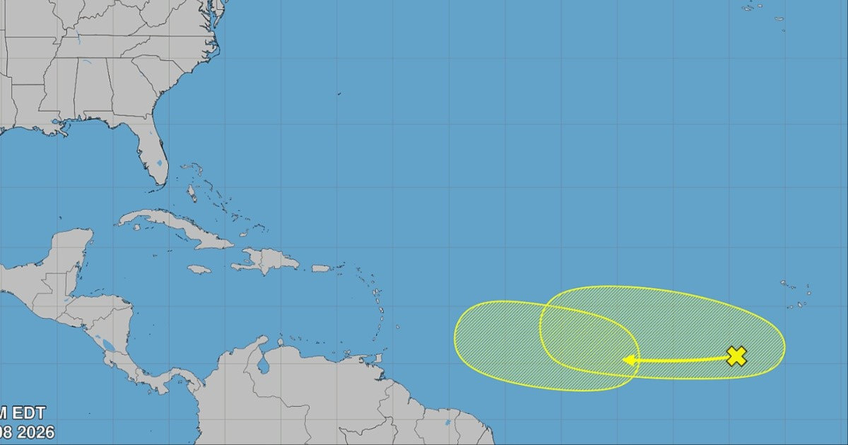
The National Hurricane Center (NHC, for its acronym in English) announced this Saturday that it is monitoring the potential development of two systems in the tropical Atlantic over the coming week, although the likelihood of cyclone formation is low for both.
In its afternoon update, the NHC stated that "the development window is narrow due to the strong winds at high levels of the atmosphere near" the two systems, which limits their chances of organizing as tropical cyclones.
The first is a tropical wave located a few hundred miles southwest of the Cape Verde Islands in the central tropical Atlantic, with a formation probability of nearly 0% over the next 48 hours and 20% over the next seven days.
The second system is another tropical wave expected to emerge from the western coast of Africa next Tuesday; its chances of development are also close to 0% in 48 hours and 30% in seven days.
Both disturbances are moving westward over the tropical Atlantic. The official graphical map from the NHC marks them in yellow, indicating probabilities below 40%, and does not pose an immediate threat to land within the seven-day period.
The announcement comes in the midst of a remarkably calm 2026 hurricane season to date: only two named storms have formed in the Atlantic —Arthur and Bertha— and neither reached hurricane strength.
The Accumulated Cyclone Energy in the Atlantic is approximately 75% below normal for this time of year, according to data from the NHC itself.
The main factor hindering activity is El Niño, which increases vertical wind shear over the Atlantic and the Caribbean, making it more difficult for cyclones to form and intensify.
The NOAA updated its seasonal forecast on Friday, maintaining the prediction for a below-normal season: between seven and 13 named storms, between two and six hurricanes, and up to two major hurricanes. The agency estimates a 75% probability that the cyclonic activity of 2026 will be below average.
Despite the relative calm, the NHC has warned that August historically marks the beginning of the peak activity period and that the climatological peak of the Atlantic season occurs around September 10, meaning the period of highest risk is still ahead.
In Cuba, the regime urged the public in early August to stock up on food and medicine due to the possibility that a system might affect the island, in line with the forecast from the Cuban Meteorological Institute (INSMET), which predicts a 40% chance that at least one hurricane will hit the country during the season.
Related videos:
Filed under: