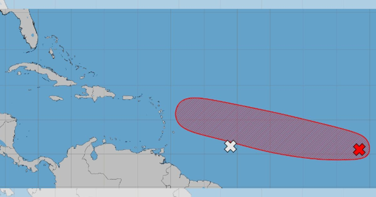
An area of low pressure located in the central tropical Atlantic maintains a 70% likelihood of development over the next seven days, as it continues to move west-west-northwest generally toward the arc of the Antilles.
The system was located this Tuesday about 500 miles southwest of the Cape Verde Islands, according to the advisory issued at 8:00 a.m. by the National Hurricane Center (NHC).
Although it is still too early to determine its definitive trajectory and possible impacts, the images shared by the NHC show that the potential development area extends to the west, generally toward the Antilles archipelago, so Cuba must pay attention to its evolution over the coming days.
The monitoring center considers it likely that a tropical depression will form during the second half of this week as the system moves across the central tropical Atlantic.
The development chance over the next 48 hours remains at 30%, while the seven-day forecast continues at 70%.
The activity of rain and thunderstorms associated with the low pressure was limited during the morning.
However, the organization anticipates that environmental conditions will become more favorable for its operations over the next two days.
The forecast maintains the high probability reached during the night on Monday, when the organization increased the chances of formation to 70%.
Hours earlier, the forecast was at 60% for seven days and 20% for the first 48 hours.
The system had experienced a consistent increase in its organizational capabilities.
The probability increased from 40% on Sunday morning to 50% in the afternoon and reached 60% on Monday, before rising to the current level.
The NHC is also monitoring another tropical wave located about 600 miles east of the Windward Islands, accompanied by disorganized rain and thunderstorms.
That second system will encounter a large mass of dry air as it approaches the islands, so its development is no longer expected.
Their formation chances decreased to nearly 0% both in 48 hours and over the next seven days.
Although it is not expected to develop into a tropical depression, the wave could bring locally heavy rainfall and gusty winds to the Lesser Antilles over the next two days.
A third area under observation corresponds to a low pressure trough located several hundred miles northeast of Bermuda. The system is producing rain and storms as it moves eastward at about 20 miles per hour.
Its chances of development remain at 10% both in 48 hours and in seven days. The NHC expects it to reach cooler waters by Thursday, which would end its chances of organization.
Related videos:
Filed under: