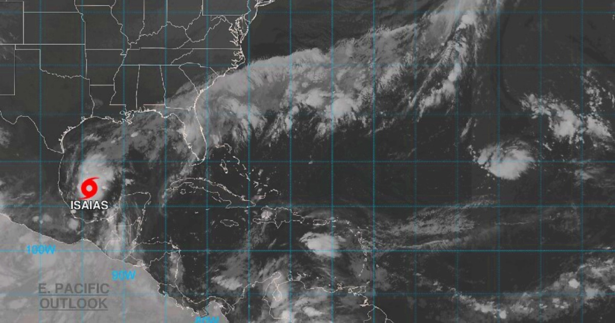
The tropical storm Isaias has formed in the southwest Gulf of Mexico in recent hours, as confirmed by the latest advisory from the National Hurricane Center (NHC), issued at 4:00 a.m. Central Time.
The system, which on Tuesday became Tropical Depression Nine, intensified rapidly and threatens to become a hurricane before making landfall on the northern Gulf Coast, presumably on Friday.
The bulletin warns that "a rapid strengthening is expected in the next day or two, and Isaías is forecasted to become a hurricane on Thursday."
If Isaiah reaches hurricane status, it will be the first of the 2026 Atlantic season, after eight named storms that did not reach that threshold.
Current Position and Characteristics
At the time of the notice, the center of Isaías was located at 22.0°N / 94.1°W, approximately 460 km west of Progreso, Mexico, and 935 km southwest of the mouth of the Mississippi River.
The maximum sustained winds reached 40 mph (65 km/h) with higher gusts, and the minimum central pressure was 1,004 mb.
The system was moving towards the east-northeast at 8 mph (13 km/h), with tropical storm-force winds extending up to 75 km from the center.
Trajectory: from Yucatán to the north of the Gulf
The NHC projects that Isaías will maintain its east-northeast trajectory during the day, before turning to the northeast and north on Thursday and Friday.
Following that path, the system would move north of the Yucatán Peninsula on Thursday and approach the northern coast of the Gulf of Mexico on Friday.
The NHC was clear about the risk to the U.S. coast: “There is a growing risk of dangerous wind and storm surge impacts along portions of the northern Gulf coast. Residents from Louisiana to the Florida Panhandle should closely monitor the latest forecast updates and ensure their hurricane plans are in place.”
The agency also anticipated that Hurricane Watches "will likely be needed for a portion of the northern Gulf coast later today."
Rain, flooding, and dangerous waves
For the Yucatán Peninsula, accumulations of between two and four inches (50-100 mm) are expected until Thursday, with isolated maxima in Campeche and western Yucatán, along with gusty winds and dangerous surf on the western and northern coasts.
For the northern Gulf Coast, between Friday and the weekend, the NHC forecasts between three and six inches of rain (75-150 mm), with isolated peaks of up to 10 inches (254 mm) from southeastern Louisiana to the Florida Panhandle.
"Flash and urban flooding is possible, along with isolated river flooding," warns the bulletin.
The rains could extend as far as the Tennessee Valley and the Carolinas.
Florida in emergency; Cuba, out of danger
Before the system received its name, the governor of Florida, Ron DeSantis, declared a state of emergency in 25 counties in the northern and northwestern parts of the state through Executive Order 26-202, which includes areas such as Escambia, Santa Rosa, Okaloosa, Bay, and Leon, among others.
The Cuban Meteorological Institute (INSMET) ruled out any threat to the island: “This system poses no danger to Cuba”, although it recommended staying informed through official channels.
A season that broke records for calmness
Isaiah arrives in an unusual context: the 2026 Atlantic season surpassed the historical record for the longest time without a hurricane in the satellite era, exceeding records from 2002 and 2013.
September 2026 ended without a single hurricane, something that had only happened three times since 1950.
The next full advisory from the NHC was scheduled for 10:00 AM CDT this Wednesday.
Related videos:
Filed under: