
Related videos:
Meteorologist Raydel Ruisánchez warned this Sunday about the presence of two troughs that will be generating unstable weather conditions over Cuba.
One of them is located in the southeastern Gulf of Mexico, and the other near the eastern part of the country.
Both systems, combined with the strong daytime heating and abundant humidity in different layers of the troposphere, will create a conducive environment for rainfall, showers, and thunderstorms, primarily in the western region and areas of the interior and southern part of eastern Cuba, as warned on Facebook.
"Extreme caution is advised in the event of thunderstorms," Ruisánchez noted, who also shared an image showing the expected rainfall totals according to the WRF-ARW mesoscale weather model.
The rain could be locally heavy and extend until the early hours of the night.
For its part, the Forecast Center of the Instituto de Meteorología de Cuba, through its channel on Telegram, indicated that in the afternoon, there will be cloud cover over much of the national territory with showers, rain, and thunderstorms, more frequent in the west and east, and more isolated in the central region.
High temperatures are also expected, with maximums between 32 and 35 degrees Celsius—higher in inland areas—and nighttime minimums between 23 and 26 degrees, slightly lower in the interior regions of the country.
The winds will be variable and light, while the sea will be calm, except for some small waves along the southeastern coast.
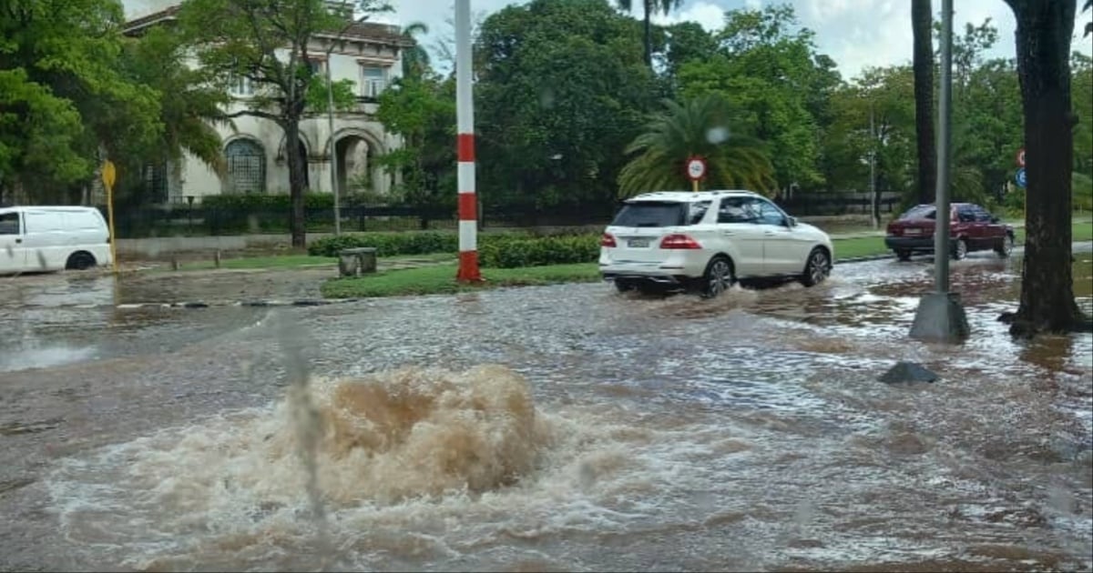
A light drizzle was enough for several streets in Havana to become flooded this Saturday, further demonstrating the collapse of the sewage system, as reported by the residents of the Cuban capital.
The Cuban photographer Sergei Montalvo Aróstegui stated on Facebook that flooding was reported in Cuatro Caminos and Centro Habana due to drainage issues.
“The same neighbors are the ones who have to step in to clear the blockages in the sewers so that the water can drain and the street can be passable,” he wrote, alongside videos of the flooding.
Just a few days ago, flooding was reported on Calzada del Cerro, where videos shared by the independent outlet CubaNet showed the iconic avenue turned into a river, with water reaching the doorways of the houses.
Urban flooding has become a part of daily life for the people of Havana. Just two weeks ago, heavy rains caused the collapse of streets and homes in several municipalities, and a tragic collapse in Cerro resulted in the death of a baby just five months old.
Meanwhile, the residents of Havana are insisting that the drains be cleaned and the sewage system be renewed.
Frequently Asked Questions about Rain and Storms in Cuba
Which regions of Cuba will be most affected by the rains and storms?
The western regions and the interior and southern part of eastern Cuba will be the most affected by the rains and thunderstorms, according to meteorologist Raydel Ruisánchez. These areas will experience a significant increase in precipitation due to the combination of two troughs and local conditions of humidity and heat.
What are the recommendations for thunderstorms in Cuba?
The meteorologist Raydel Ruisánchez recommends taking extreme caution during thunderstorms due to their danger and potential severe effects in vulnerable areas. It is important to stay informed through official channels and take safety measures to protect oneself from electrical strikes and possible flooding.
Why are there so many rains and storms occurring in Cuba?
The presence of two troughs and the strong daytime heating are the main factors behind the increase in rain and storms in Cuba. These weather systems, combined with abundant moisture in the troposphere, create a conducive environment for atmospheric instability and heavy rainfall, especially during the afternoon and night.
Filed under: