
Related videos:
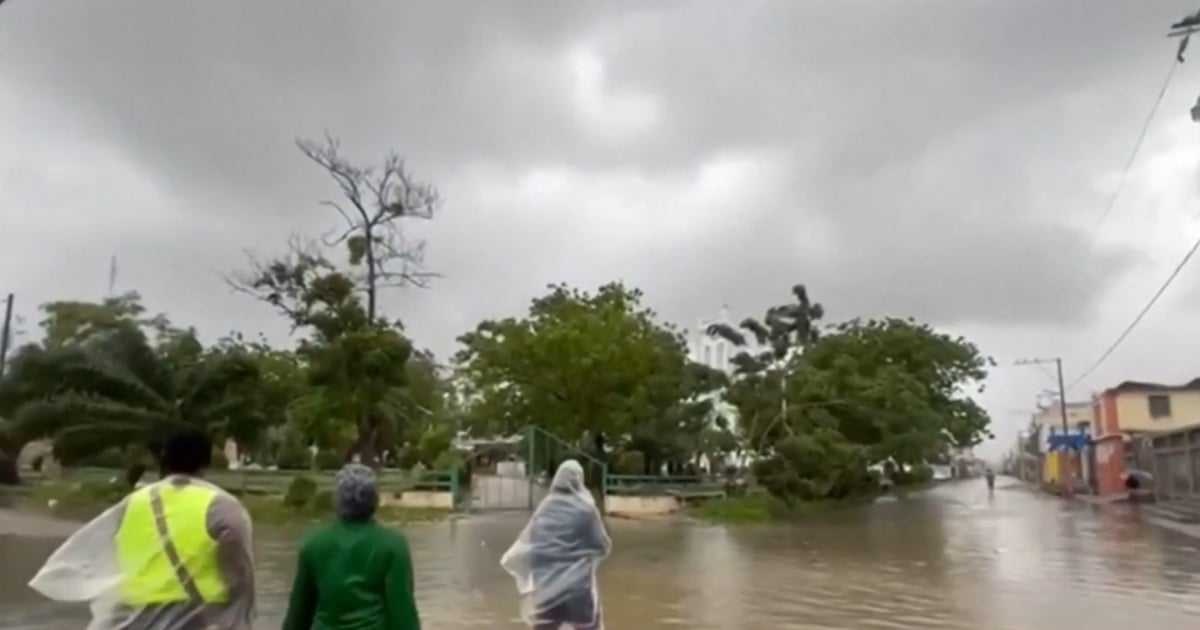
The National Hurricane Center (NHC) warned that catastrophic and fatal flash floods and numerous landslides could occur in Jamaica between tonight and Tuesday as the core of Hurricane Melissa moves over the island.
The agency urged the population to remain in safe shelters and not to go outside, also warning of catastrophic winds of 280 km/h and storm surge that threaten lives along the southern coast.
At 5:00 PM EDT, the center was located at 16.7°N, 78.4°W, 140 miles (225 km) southwest of Kingston, moving very slowly northwest at 3 mph (6 km/h).
The NHC forecasts that Melissa will move near or over Jamaica between tonight and Tuesday, cross the southeast of Cuba on Tuesday night and pass over the southeast or central Bahamas on Wednesday, with a gradual turn to the north and then northeast, increasing speed of movement between Tuesday and Thursday.
Although fluctuations in intensity are possible before the direct impact on Jamaica, the official forecast maintains the system as an extremely powerful major hurricane as it approaches Jamaica and southeast Cuba, and still with hurricane strength over the Bahamas.
The wind field confirms the danger of the phenomenon: hurricane-force winds extend 30 miles (45 km) from the center and tropical storm winds extend up to 195 miles (315 km).
The notice emphasizes that there is likely a total structural failure in the eye wall, particularly in elevated areas, where gusts can be up to 30% stronger than at sea level.
For Jamaica, the storm surge along the southern coast could reach 9 to 13 feet above ground level, accompanied by large and destructive waves; on the northwest coast, near Montego Bay, it could reach 1 to 3 feet.
In terms of rainfall, the NHC projects 15 to 30 inches for portions of Jamaica and an additional 6 to 12 inches for the south of Hispaniola by Wednesday, with total maxima of 40 inches possible; the forecast indicates a likelihood of catastrophic flash flooding and numerous landslides.
For the east of Cuba, 10 to 20 inches of rainfall is expected, with peaks of 25 inches from Monday to Wednesday, posing a risk of flash floods that threaten life and landslides.
In the Bahamas, the estimated total is 5 to 10 inches between Tuesday and Wednesday, enough to cause areas of flash flooding.
The advisory and watch outlook reflects the seriousness of the situation: there is a Hurricane Warning for Jamaica, the Cuban provinces of Granma, Santiago de Cuba, Guantánamo, and Holguín, and for the southeast and central Bahamas; a Hurricane Watch for Turks and Caicos; and a Tropical Storm Warning for Haiti, Las Tunas (Cuba), and Turks and Caicos.
The NHC highlighted that preparations to protect life and property must be complete in Jamaica and expedited in Cuba, while urging the population to pay attention to key messages and bulletins from their national meteorological services.
According to the path and scale of the system, the NHC warned that dangerous waves and ocean currents will spread across Hispaniola, Jamaica, eastern Cuba, and the Cayman Islands in the coming days, and later affect the Bahamas, Turks and Caicos, and Bermuda.
Hurricane-hunting aircraft from the Air Force Reserve are scheduled to investigate the cyclone again in the coming hours, aiming to refine intensity and internal structure estimates as the hurricane interacts with Jamaica.
Filed under: