The National Hurricane Center (NHC) warned this Tuesday that Melissa remains an extremely dangerous hurricane: after making landfall earlier in the afternoon on the southwestern coast of Jamaica, the eye has crossed the island and is now emerging off the northern coast, about 15 miles east of Montego Bay, moving northeast at 8 mph.
The agency warned that tonight in Jamaica, there will be "catastrophic rains and winds, with destructive winds", flash flooding, and landslides, and urged people to remain in shelters and follow local advice.
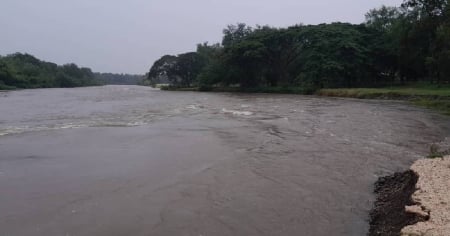
For Jamaica, the NHC maintains a hurricane warning and anticipates an additional 15 to 30 centimeters of rain across the island, with isolated storms capable of bringing up to 75 centimeters, prolonging a scenario of flash flooding that poses a threat to life, with the greatest danger in mountainous and high-elevation areas.
The official message emphasizes that “there are very dangerous hours ahead” and that the population should spend the night in safe places until authorities indicate otherwise.
The center of Melissa moves toward the southeast of Cuba during the night and the early hours of Wednesday, where tropical storm conditions have already begun to be felt.
The NHC forecasts a very powerful hurricane impact on the southeast coast of the country, with widespread damaging winds near the core of the cyclone, a storm surge of 8 to 12 feet above normal tide levels, and very intense rainfall: accumulations of 10 to 20 inches, with maxima of up to 25 inches from Manzanillo to Santiago de Cuba and Guantánamo, where the agency anticipates catastrophic flash flooding and numerous landslides.
The recommendation is to stay sheltered and prepare for hurricane-force winds, dangerous swells, and flooding as the system progresses and its movement accelerates.
After its passage through eastern Cuba, Melissa will move over the southeastern Bahamas between Wednesday afternoon and evening.
Hurricane alerts are in effect, with possible hurricane-force winds, swells of 1.5 to 2.5 meters of flooding above ground level, and rainfall amounts ranging from 12 to 25 centimeters, particularly in very low-lying islands, where the risk of flooding is high.
Later, the system will accelerate toward the western Atlantic and pass near or just west of Bermuda between Thursday night and Friday morning; the island is under a hurricane alert.
The call, both in Jamaica and in eastern Cuba, the Bahamas, and the Turks and Caicos Islands, is to stay in shelter, protect life and property, and follow the communications from meteorological services and Civil Defense in each territory.
Filed under: