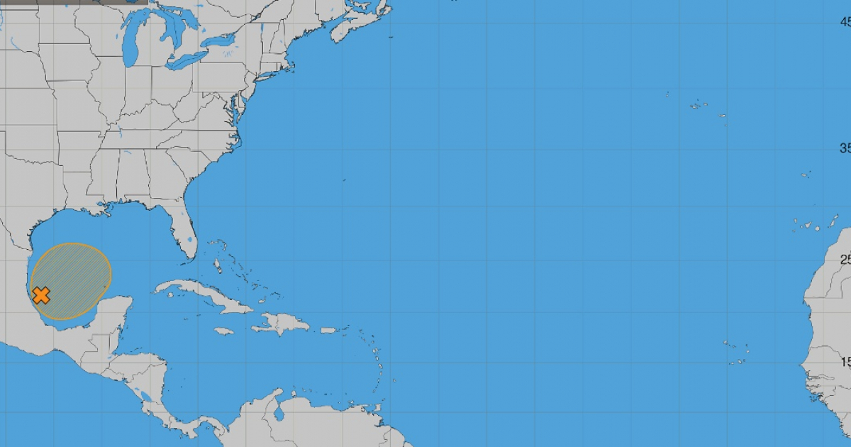
The National Hurricane Center (NHC) of the United States issued this morning the latest bulletin monitoring a tropical disturbance in the southwestern Gulf of America, which has a formation probability of 50% in the next seven days.
The notice describes the system as a “shallow low-pressure trough” developed along the coast of Mexico, in the southwest Gulf.
According to the agency, “although environmental conditions are expected to be only marginally favorable, a gradual development of this system is possible, and a tropical depression could form in the second half of this week.”
The NHC adds that the system will initially move “toward the east before turning north”, a development that will be closely monitored in the coming days.
At the moment, the NHC does not indicate an immediate cyclone threat for Cuba or Florida, although the potential for development will increase as the week progresses.
The "48-hour formation probability" is merely 10%, rated as low, while the "seven-day formation probability" rises to 50%, considered medium.
At the moment, there is no formed tropical depression, and therefore, no official track cone either.
The NHC bulletin does not establish a specific impact scenario for Cuba or Florida at this stage, so we must wait for the system's development and the upcoming updates.
The meteorologist Bryan Norcross from Fox Weather analyzed the system this Sunday and emphasized the high level of uncertainty present.
The models showed a poorly defined signal regarding its potential development and trajectory, while the winds at upper levels over the northern Gulf would be "extremely hostile" to its organization.
Norcross considered it more likely that the phenomenon will end up being a broad area of rain and storms over the Gulf and Florida rather than a major tropical system.
Florida is already facing heavy rains
Regardless of whether the disturbance develops into a tropical depression or not, Florida is already facing a heavy rainfall episode, particularly in the northern and northwestern parts of the state.
The National Weather Service (NWS) had forecast widespread accumulations of between three and six inches in sections of the western Panhandle of Florida, with localized amounts ranging from eight to ten inches.
This Monday, the agency has issued flood warnings for much of that region.
In total, Florida is preparing to receive an enormous volume of rain over these days, estimated by meteorologist Matt Devitt to be around 4.6 trillion gallons of water in seven days.
The evolution of the Gulf disturbance should be monitored separately, as there is still a high level of uncertainty about how much it will organize and what its final trajectory will be.
An exceptionally calm hurricane season
The emergence of this disturbance occurs during an extraordinarily calm hurricane season in the Atlantic.
According to the NHC report updated on October 4, 2026, eight named storms have formed, and so far, none have reached hurricane status.
The eight systems recorded so far are Arthur, Bertha, Cristobal, Dolly, Edouard, Fay, Gonzalo, and Hanna, all classified as tropical storms.
The anomaly is significant: at this time of year, the climatic average for 1991-2020 is around 11 named storms, five hurricanes, and two major hurricanes.
The Accumulated Cyclone Energy (ACE) for 2026 was also 89% below normal by the end of October 4th.
The calm had already made history weeks ago.
The meteorologist Matt Devitt noted on September 21 that one would have to go back to 1914 to find a season that had reached this far in the calendar without recording a hurricane.
"The last time we reached this far into the season with zero hurricanes in the Atlantic was during World War I, in 1914. I had never seen anything like it," he wrote then.
One of the factors that may contribute to this low activity is El Niño.
The National Oceanic and Atmospheric Administration (NOAA) explains that this phenomenon increases the vertical wind shear over the Atlantic, a condition that tends to hinder both the formation of tropical storms and their intensification.
In its August update, NOAA placed the probability that 2026 will end with a below-normal season at 75% and projected between seven and 13 named storms, of which two to six could develop into hurricanes and up to two could reach major intensity.
October remains the month of highest risk for Cuba
However, a somewhat inactive season does not mean that the danger has disappeared. The Atlantic hurricane season officially runs until November 30 and October holds particular historical significance for Cuba.
A study published in the Cuban Journal of Meteorology, which is based on the hurricanes that affected Cuba and its surrounding seas between 1791 and 2016, identifies October as the month with the highest frequency of hurricanes, accounting for 35.5% of the cases, followed by September (31.4%) and August (15.7%).
Intense hurricanes also register their highest frequency in October.
The last few years have provided examples of the threat that cyclones can pose during this stage of the season. Oscar swept across eastern Cuba in October 2024, bringing torrential rains and potentially deadly flash floods.
A year later, Melissa made landfall in the eastern part of Cuba on October 29, 2025, as a category 3 hurricane, with sustained winds of up to 205 km/h. The cyclone caused severe flooding and landslides and affected more than 3.5 million people.
Related videos:
Filed under: