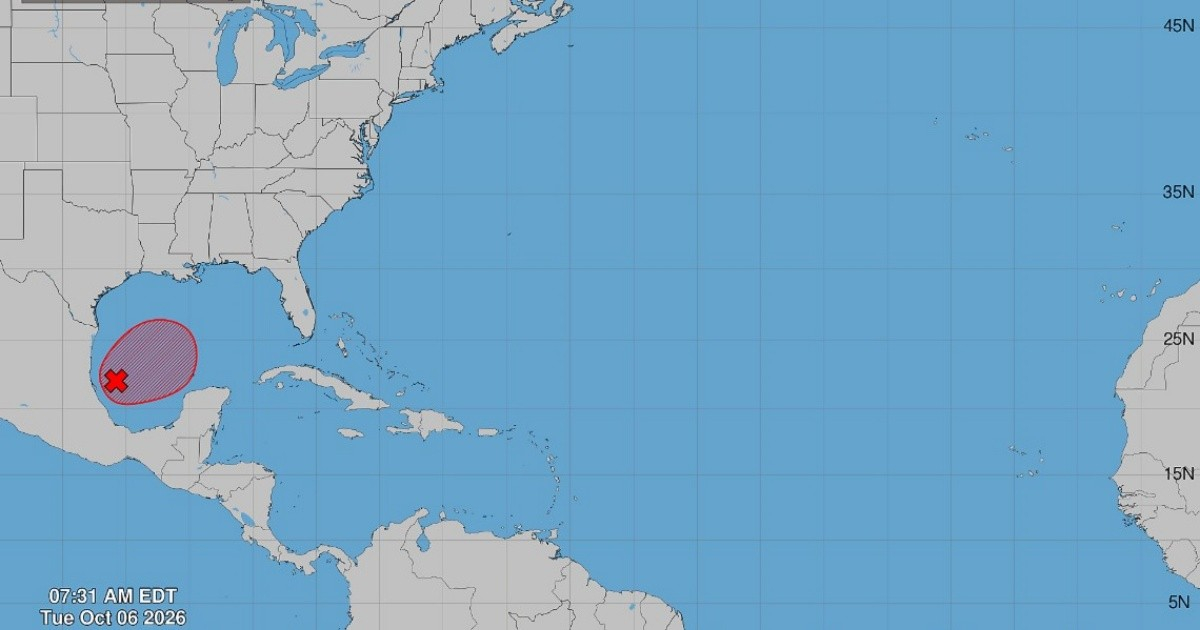
The National Hurricane Center (NHC) of the United States raised the probability of a tropical depression forming in the southwestern Gulf of America to 90% this Tuesday, according to the official bulletin issued at 8:00 a.m. EDT.
The system, designated as 92L, went from a 10% chance of formation in 48 hours to a 90% likelihood of development in less than 24 hours.
A system that organizes itself quickly
The NHC bulletin states that “showers and thunderstorms exhibiting signs of organization are observed associated with a large area of low pressure located over the southwestern Gulf of America.”
The agency anticipates that the system “will continue to develop and that a tropical depression will form in the coming days as it moves eastward.”
Planned route: Yucatán first, northern Gulf coast afterwards
According to the NHC, "the low-pressure area could bring strong winds and heavy rains to the western areas of the Yucatán Peninsula, Mexico, in a couple of days."
Subsequently, the agency expects that "the disturbance will turn toward the north or northeast, heading toward the northern Gulf coast by the end of the week."
The warning was explicit: "It is still too early to determine the specific impacts on the northern Gulf coast, but those in the area from northwest Florida to Louisiana should closely monitor the development of this system."
Reconnaissance planes on the way
To better characterize the system's environment, the NHC reported that "the NOAA Gulfstream aircraft is scheduled to collect samples from the environment over the Gulf later today, and a reconnaissance aircraft from the Air Force is set to investigate the system tomorrow."
This dual aerial mission will provide direct data on the structure and winds of the system, enhancing the accuracy of forecasts in the coming hours.
Rubiera had already warned him
The Cuban meteorologist José Rubiera predicted on Monday night that system 92L "will very likely become a tropical cyclone" and could reach at least the category of tropical storm.
Rubiera placed the area of highest probability of impact between Mississippi and Alabama, with margins extending from Louisiana to the northwest of Florida.
Some models anticipated a strengthening to hurricane status, although the expert was cautious: "This can change significantly because the cyclone has not yet fully formed."
A historically calm season that could change
The emergence of 92L contrasts with the exceptionally calm nature of the 2026 Atlantic hurricane season: by October 4, eight named storms had formed, and none had reached hurricane status, a phenomenon not seen since 1914.
The El Niño phenomenon was identified as the main culprit for this calm, as it increases the vertical wind shear over the Atlantic.
The season officially extends until November 30, while the rapid organization of 92L brings the spotlight back to cyclonic activity in the Gulf.
Related videos:
Filed under: