
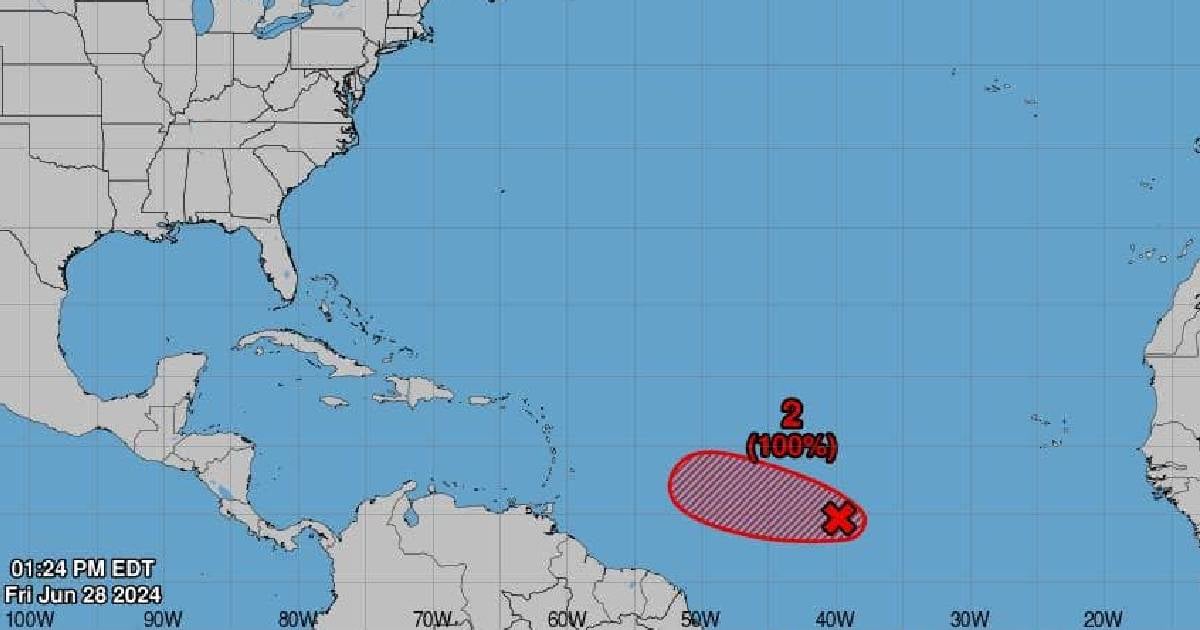
The National Hurricane Center (NHC) in Miami reported that a tropical wave located about 1,400 miles east-southeast of the Leeward Islands has a 100% chance of becoming a hurricane in the next few days.
This low-pressure system, designated as AL95, is showing an increase in the organization of the associated rain and storms, and could transform into Tropical Depression Beryl as early as this Friday, the statement indicates.
The NHC has indicated that the system is moving westward at a speed of between 15 and 20 mph and is expected to reach the Leeward Islands by the end of the weekend.
The entity asserts that due to this trajectory, it is likely that hurricane or tropical storm warnings will be issued for some parts of the region tonight or early Saturday.
According to international forecast models, the cyclone would reach the southern group of the Lesser Antilles as a Category 2 or Category 3 hurricane on Monday as it moves into the eastern Caribbean Sea heading northwest towards Jamaica and near the southern coast of the eastern region of Cuba.
The Cuban regime reported on Facebook that the forecast for the southern group of the Lesser Antilles arc is very reliable, but once it enters the eastern Caribbean, there is much uncertainty about its possible trajectory. Some believe that the trajectory will be directly towards Cuba while others indicate that it will move towards the Yucatan Peninsula and Central America.
The hurricane would be named Beryl.
Additionally, another area of low pressure (AL94) over the western Caribbean Sea is producing a significant amount of rain and thunderstorms; although significant development of this disturbance is not expected today, there is a possibility that it may develop as it moves over the Yucatan Peninsula and emerges in the Bay of Campeche by late Saturday or early Sunday.
This system will also bring heavy rains to parts of Central America and Mexico during the weekend. The chances of this system forming in the next 48 hours and in the next seven days are 30%.
A third system, a tropical wave located several hundred miles south-southwest of the Cape Verde Islands, is producing disorganized rain and storms. Although the development of this system is slow, there is a possibility that it will organize better next week as it moves westward across the central and western tropical Atlantic. The likelihood of formation in the next seven days is 30%.
American and Cuban meteorologists have predicted that the current hurricane season will be the most active in the last 40 years.
What do you think?
COMMENTFiled under: